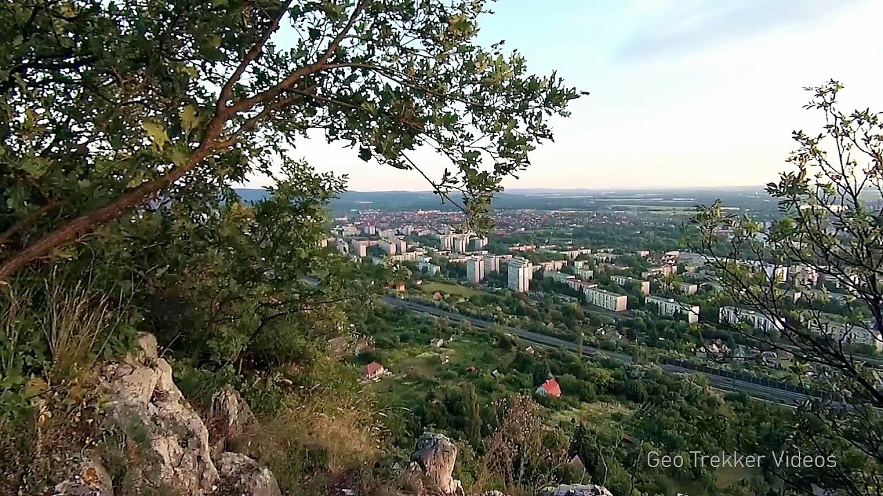
Balázs Hill Lookout - Western Mecsek

The Balázs hill lookout, located at an altitude of 320 meters, offers a beautiful view of Lake Pécs and the wooded mountain ranges of Western Mecsek. The original lookout, built in 1975, was destroyed by fire, and it was rebuilt in 2001 using a metal structure, which was renovated in 2014.
Planned hiking destination. Copyright © Trekkingklub
Already published 8166 photos and 136 videos. Please register for full access.
Photos of nearby places

Slunjcica - Rastoke, Slunj - Croatia (12 photos) 229.18 km away
The Slunjcica river is situated in central Croatia, flowing through the Kordun region. The city of Slunj is named after this river.

Plitvice Lakes - Croatia (60 photos) 240.98 km away
The Plitvice Lakes National Park is the oldest and largest national park in Croatia. It is located in a mountainous region between Mala Kapela and Licka Pljesivica.

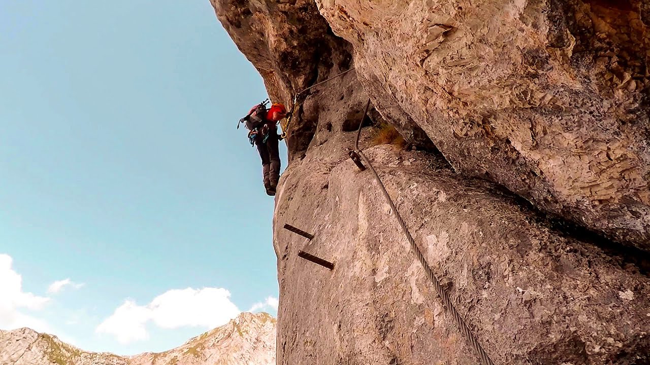
Mariazell climbing route, Felix's Celestial Ladder, Devil's Bridge - Climbing Park Spielmäuer (60 photos) 275.05 km away
Climbing Park Spielmäuer - Mariazell climbing route, Felix's Celestial Ladder, Devil's Bridge (Kletterpark Spielmäuer - Mariazeller Steig, Felix Himmelsleiter, Teufelsbrücke) - Wegscheid, Austria.

The Devil's Bridge (Teufelsbrücke) - Wegscheid, Austria (18 photos) 275.86 km away
The Devil's Bridge, Teufelsbrücke in German, is located just ten kilometers from the city of Mariazell, near the Klettersteigpark Spielmäuer via ferrata park. From the top of the via ferrata park, it is worth taking a detour to the Devil's Bridge, which is located near the starting point of the descent path.

Manita pec cave - Croatia (21 photos) 291.6 km away
There are 115 caves so far known in the Paklenica National Park, Manita pec is the most famous one, and is open to the public for guided visits. The cave has beautiful chambers, and various cave formations such as stalagmites, stalactites, columns, and flowstones.

Paklenica National Park - Croatia (55 photos) 294.17 km away
In 1949, the area of Velika and Mala Paklenica was designated as a national park due to its natural features, forests, and geomorphologic structures. The main purpose was to protect the largest and best-preserved forest complex in Dalmatia, which was at risk from excessive exploitation.

Port of Jablanac - Croatia (18 photos) 299.63 km away
Situated in Lika-Senj county, Croatia, Jablanac is a village located beneath the Velebit mountain, overlooking the neighboring island of Rab in the Adriatic Sea. In close proximity to Jablanac are the Velebit mountain and the Northern Velebit National Park.
[ Top ↑ ]
Videos of nearby places
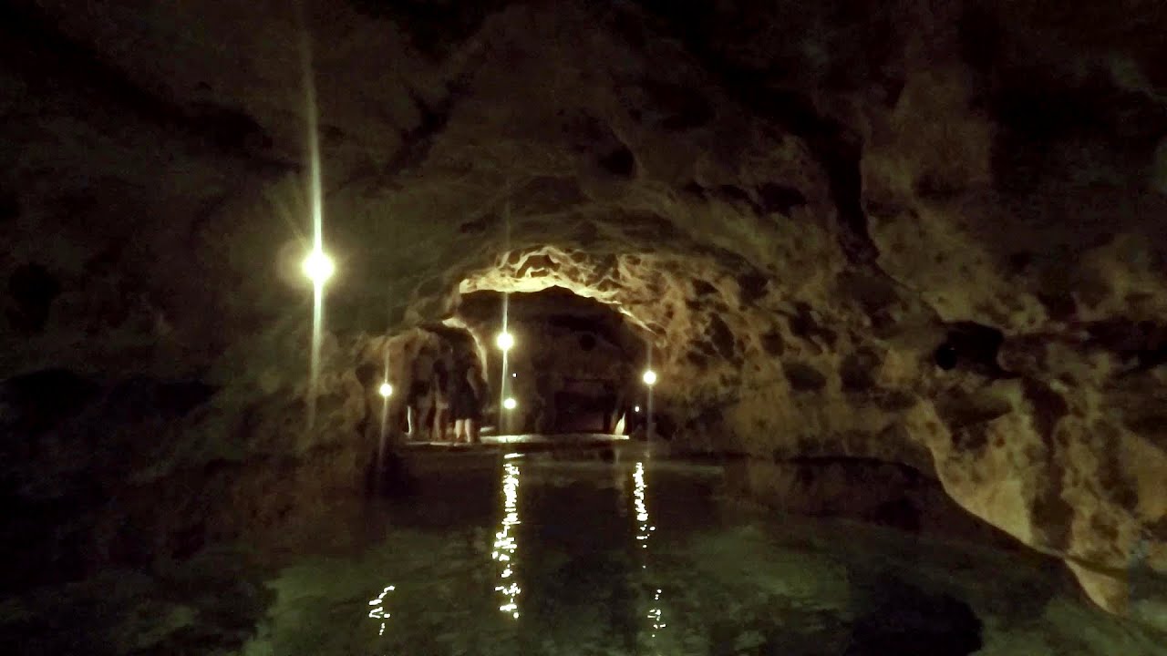
Tapolca lake cave - Balaton-felvidéki National Park 98.62 km away
The Tapolca lake cave is situated in the Balaton-felvidéki National Park. A modern visitor center has been constructed at its entrance, featuring ten rooms that highlight the unique characteristics of karst regions.
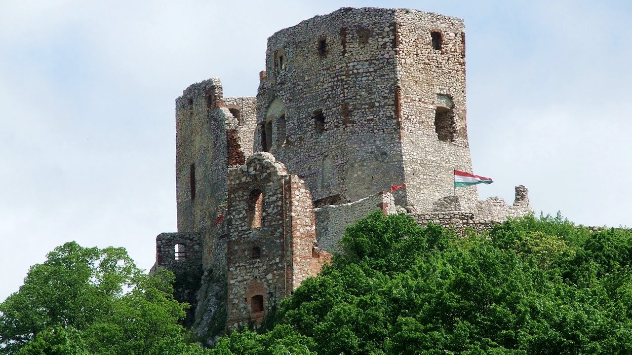
Castle panorama route, Zoltán Tálos memorial route, Besieger's route - Csesznek 136.23 km away
Castle panorama route (D), Zoltán Tálos memorial route (E), Besieger's route (C), Kőmosó-ravine, Csesznek, Veszprém county, Hungary. The via ferratas in Csesznek are suitable for both getting acquainted with climbing, and assessing our capabilities.
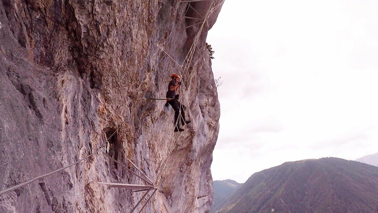
Play Wall via ferrata park - Mariazeller via ferrata, Felix's Ladder to the Heaven, Devil's Bridge 275.05 km away
Located only ten kilometers from the town of Mariazell, you'll find the via ferrata park known as the Play Wall (Klettersteigpark Spielmäuer). Here, we find three via ferratas: Olivers Mariazeller Steig (B/C), Felix Himmelleiter (D), and Tristans Kirchbogensteig (C).
Kaiserschild Klettersteig - Eisenerzer Ramsau 296.18 km away
The 2,085-meter-high Kaiserschild peak is situated on the northern edge of the Eisenerz Alps in Styria, Austria. It forms a double summit with the slightly taller Hochkogel peak, which stands at 2,105 meters.
Other places
Giant Ice Cave (Rieseneishöhle) Dachstein Salzkammergut, Obertraun am Hallstättersee 370.78 km away
The second cave accessible to the public at the Schönbergalm above Obertraun on Lake Hallstatt is the Giant Ice Cave (Rieseneishöhle). For me, it was more spectacular than the Mammoth Cave.
The second cave accessible to the public at the Schönbergalm above Obertraun on Lake Hallstatt is the Giant Ice Cave (Rieseneishöhle). For me, it was more spectacular than the Mammoth Cave.
Silberkar Gorge (Silberkarklamm) Ramsau am Dachstein, Austria 366.79 km away
One of the most beautiful hiking spots in the area of Ramsau am Dachstein, is the Silberkarklamm. It is possible to drive to the entrance of the gorge, there is parking available on the side of the road, and you have to pay an entrance fee.
One of the most beautiful hiking spots in the area of Ramsau am Dachstein, is the Silberkarklamm. It is possible to drive to the entrance of the gorge, there is parking available on the side of the road, and you have to pay an entrance fee.
Pobiti Kamani (Stone Forest) Slanchevo 821.36 km away
The Stone Forest of Bulgaria is located 18 km west of Varna, at the foothills of the Eastern Balkan Mountains. Its Bulgarian name, Pobiti Kamani, translates to planted stones, and it is referred to in English as the Stone Desert or Stone Forest.
The Stone Forest of Bulgaria is located 18 km west of Varna, at the foothills of the Eastern Balkan Mountains. Its Bulgarian name, Pobiti Kamani, translates to planted stones, and it is referred to in English as the Stone Desert or Stone Forest.
Small Via ferrata Rasnoavei Gorges 574.43 km away
In the past few days, it has snowed, so I climbed the two climbing routes in the Rasnoavei Gorge under winter conditions. While the lower part of the challenging Big via ferrata was dry, the upper section had patches of snow and icicles.
In the past few days, it has snowed, so I climbed the two climbing routes in the Rasnoavei Gorge under winter conditions. While the lower part of the challenging Big via ferrata was dry, the upper section had patches of snow and icicles.
Kodzha in (Golyamata Peshtera, Big Cave) Nochevo 736.23 km away
[ Top ↑ ]
[ Top ↑ ]
Copyright © 2003-2025 Trekkingklub and friends. Reproduction of any text, picture or video from this website, either in printed or electronic form, is prohibited without prior written permission. The given distances are to be understood as straight line distances, and are approximate. Website made in Miercurea Ciuc  .
.