Snow-covered valley of Balea and the Transfagarasan in winter - The ascent - video


The Fagarasi Mountains can be easily approached from the north, mainly by using the Transfagarasan Road. This high altitude mountain road is only accessible during the summer months (throughout its entire length), but from the Balea Waterfall station (Statia Balea Cascada) you can also reach the Balea Lake by cable car.
Fuji FinePix S5500. Copyright © 2012 - 2025 Geo Trekker Videos.
Already published 8167 photos and 136 videos. Please register for full access.
Photos of nearby places


[ Top ↑ ]
Videos of nearby places


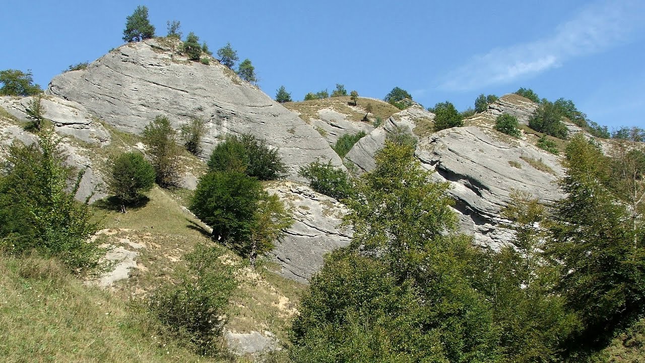
Stan Valley Canyon in winter 30.25 km away
The Stan Valley is a picturesque canyon, even in winter. In fact, when the stream is frozen and covered with a layer of snow, exploring the canyon becomes much quicker and easier.

Stan Valley Canyon 30.59 km away
The Stan Valley is located near Lake Vidraru, southwest of it, in the Fruntii Mountains. Those who have visited the Seven Ladders Waterfall will appreciate this canyon, outfitted with infrastructure for tourist accessibility.

Poenari citadel - Arges valley 31.56 km away
The Poenari citadel is located on the southern slope of the Fagaras Mountains, on the western side of the Transfagaras road, in the Arges Valley, about 4 km from the Vidraru Lake dam. Along a steep incline, a concrete staircase leads up to the castle, which is built atop a mountain.
Doabra Stones - Brezoi, Lotru Mountains 42.15 km away
The DN7A road branches off west from the Olt Valley, from the main road between Sibiu and Ramnicu Valcea, leading towards Voineasa and Lake Vidra. The first settlement is a small town, Brezoi, which is located at the confluence of the Lotru and Olt rivers.
Other places
Echernwand via ferrata, World Heritage View Hallstatt, Salzberg, Dachstein Mountains 863.67 km away
I climbed the via ferrata on the Echernwand rock wall at dusk. This route is located above one of Austria's most beautiful lakes, and above Hallstatt.
I climbed the via ferrata on the Echernwand rock wall at dusk. This route is located above one of Austria's most beautiful lakes, and above Hallstatt.
Hias via ferrata Silberkarklamm, Ramsau am Dachstein 855.94 km away
The Hias via ferrata in the Silberkar Gorge (Silberkarklamm) is the first of the three via ferrata routes, and perhaps the easiest to complete. Two cable bridges and a few trickier sections make it interesting, but it is truly impressive due to the view of the narrow gorge.
The Hias via ferrata in the Silberkar Gorge (Silberkarklamm) is the first of the three via ferrata routes, and perhaps the easiest to complete. Two cable bridges and a few trickier sections make it interesting, but it is truly impressive due to the view of the narrow gorge.
Giant Ice Cave (Rieseneishöhle) Dachstein Salzkammergut, Obertraun am Hallstättersee 857.58 km away
The second cave accessible to the public at the Schönbergalm above Obertraun on Lake Hallstatt is the Giant Ice Cave (Rieseneishöhle). For me, it was more spectacular than the Mammoth Cave.
The second cave accessible to the public at the Schönbergalm above Obertraun on Lake Hallstatt is the Giant Ice Cave (Rieseneishöhle). For me, it was more spectacular than the Mammoth Cave.
Nobody's lake Miercurea Ciuc 119.57 km away
The passage of time (time lapse), dusk at Nobody's Lake. Miercurea Ciuc and the Sumuleu mountain can be seen in the background.
The passage of time (time lapse), dusk at Nobody's Lake. Miercurea Ciuc and the Sumuleu mountain can be seen in the background.
Preacher's Rock Bodoc Mountains 108.25 km away
In the Bodoc Mountains, west-southwest from the Henter peak, we find a rock formation shaped like a mushroom by erosion, called Preacher's Rock. This 2-meter high rock probably got its name from the pagan Hungarian priests, who preached here in the past.
In the Bodoc Mountains, west-southwest from the Henter peak, we find a rock formation shaped like a mushroom by erosion, called Preacher's Rock. This 2-meter high rock probably got its name from the pagan Hungarian priests, who preached here in the past.
[ Top ↑ ]
[ Top ↑ ]
Copyright © 2003-2025 Trekkingklub and friends. Reproduction of any text, picture or video from this website, either in printed or electronic form, is prohibited without prior written permission. Nearby settlements: Cartisoara 10.25 km away, Tourist attractions near Cartisoara 10.25 km away. The given distances are to be understood as straight line distances, and are approximate. Website made in Miercurea Ciuc  .
.