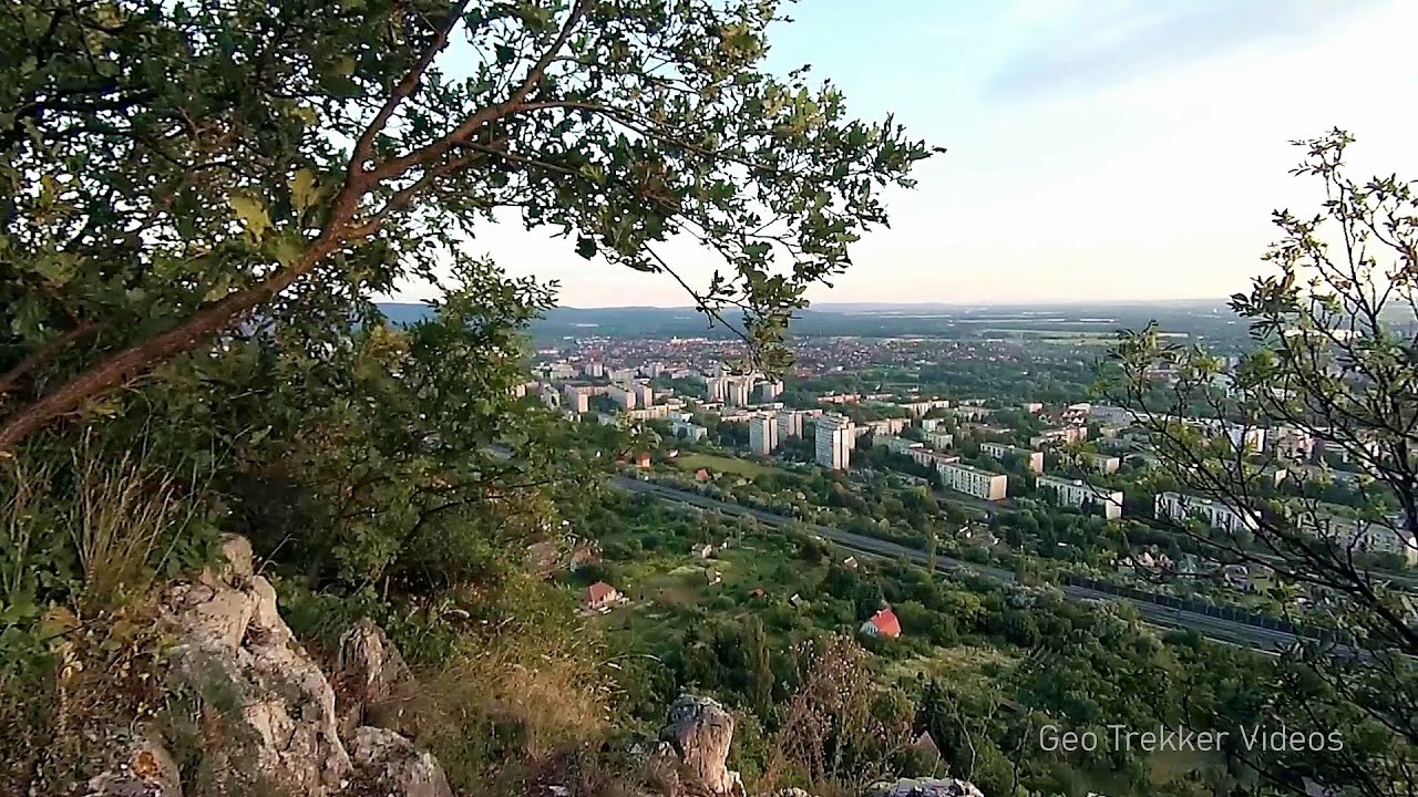
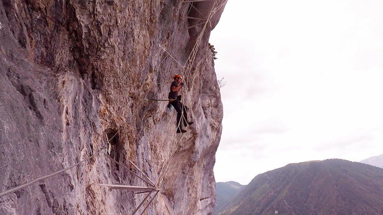
Castle panorama route, Zoltán Tálos memorial route, Besieger's route - Csesznek - video


Castle panorama route (D), Zoltán Tálos memorial route (E), Besieger's route (C), Kőmosó-ravine, Csesznek, Veszprém county, Hungary. The via ferratas in Csesznek are suitable for both getting acquainted with climbing, and assessing our capabilities. Read more
Filmed with SJCAM SJ5000 Plus. Music: Rainmaker by Aaron Mist. Copyright © 2015 - 2025 Geo Trekker Videos.
Already published 8162 photos and 136 videos. Please register for full access.
Photos of nearby places

Mariazell climbing route, Felix's Celestial Ladder, Devil's Bridge - Climbing Park Spielmäuer (60 photos) 195.63 km away
Climbing Park Spielmäuer - Mariazell climbing route, Felix's Celestial Ladder, Devil's Bridge (Kletterpark Spielmäuer - Mariazeller Steig, Felix Himmelsleiter, Teufelsbrücke) - Wegscheid, Austria.

The Devil's Bridge (Teufelsbrücke) - Wegscheid, Austria (18 photos) 196.56 km away
The Devil's Bridge, Teufelsbrücke in German, is located just ten kilometers from the city of Mariazell, near the Klettersteigpark Spielmäuer via ferrata park. From the top of the via ferrata park, it is worth taking a detour to the Devil's Bridge, which is located near the starting point of the descent path.

Slunjcica - Rastoke, Slunj - Croatia (12 photos) 304.34 km away
The Slunjcica river is situated in central Croatia, flowing through the Kordun region. The city of Slunj is named after this river.

Plitvice Lakes - Croatia (60 photos) 323.74 km away
The Plitvice Lakes National Park is the oldest and largest national park in Croatia. It is located in a mountainous region between Mala Kapela and Licka Pljesivica.

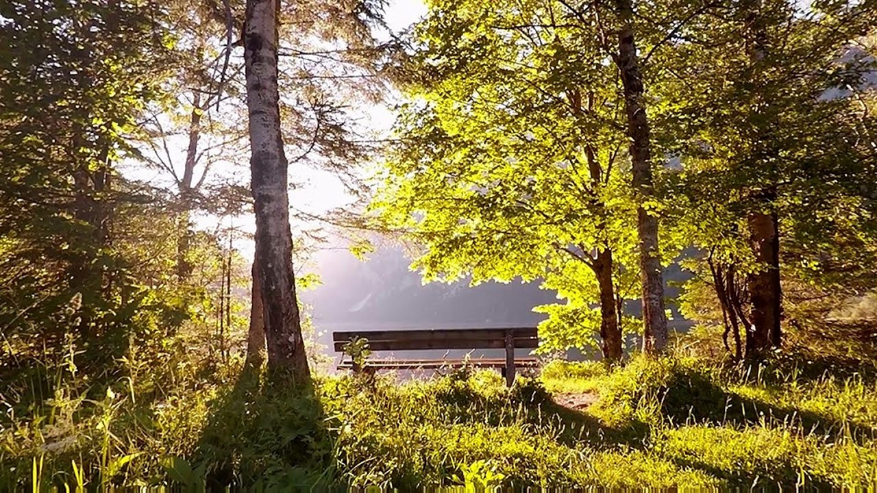
Lake Bohinj - Upper Carniola, Slovenia (10 photos) 326.5 km away
Lake Bohinj, also known as Bohinjsko jezero in Slovene and Wocheiner See in German, is the biggest permanent lake in Slovenia, covering a vast area of 318 hectares. Situated in the Bohinj Valley of the Julian Alps, in the northwestern region of Upper Carniola (Gorenjska, Alta Carniola, Oberkrain), it forms a part of the Triglav National Park.

Vogel Ski Resort - Slovenia (33 photos) 330.19 km away
Vogel Ski Resort is situated in Slovenia, above Bohinj and adjacent to Lake Bohinj, on the outskirts of Triglav National Park. The resort derives its name from the nearby Mount Vogel, and was established in 1964.

Postojna Cave - Slovenia (12 photos) 330.59 km away
The Postojna Cave (Postojnska jama) is a renowned tourist attraction located in Slovenia. It is a network of underground galleries and halls, stretching over 24 kilometers, known for its geological formations, including stalagmites and stalactites.
[ Top ↑ ]
Videos of nearby places
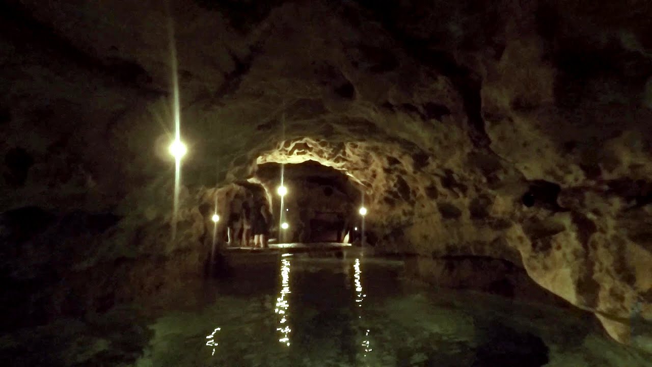
Tapolca lake cave - Balaton-felvidéki National Park 61.61 km away
The Tapolca lake cave is situated in the Balaton-felvidéki National Park. A modern visitor center has been constructed at its entrance, featuring ten rooms that highlight the unique characteristics of karst regions.
Play Wall via ferrata park - Mariazeller via ferrata, Felix's Ladder to the Heaven, Devil's Bridge 195.63 km away
Located only ten kilometers from the town of Mariazell, you'll find the via ferrata park known as the Play Wall (Klettersteigpark Spielmäuer). Here, we find three via ferratas: Olivers Mariazeller Steig (B/C), Felix Himmelleiter (D), and Tristans Kirchbogensteig (C).
Leopoldsteiner lake - Eisenerz, Steiermark 228.35 km away
Leopoldsteiner See is located in Styria, 4 km northwest of the town of Eisenerz. It lies at an elevation of 628 meters above sea level in the western part of the Hochschwab mountain range, at the foot of the Seemauer cliff.
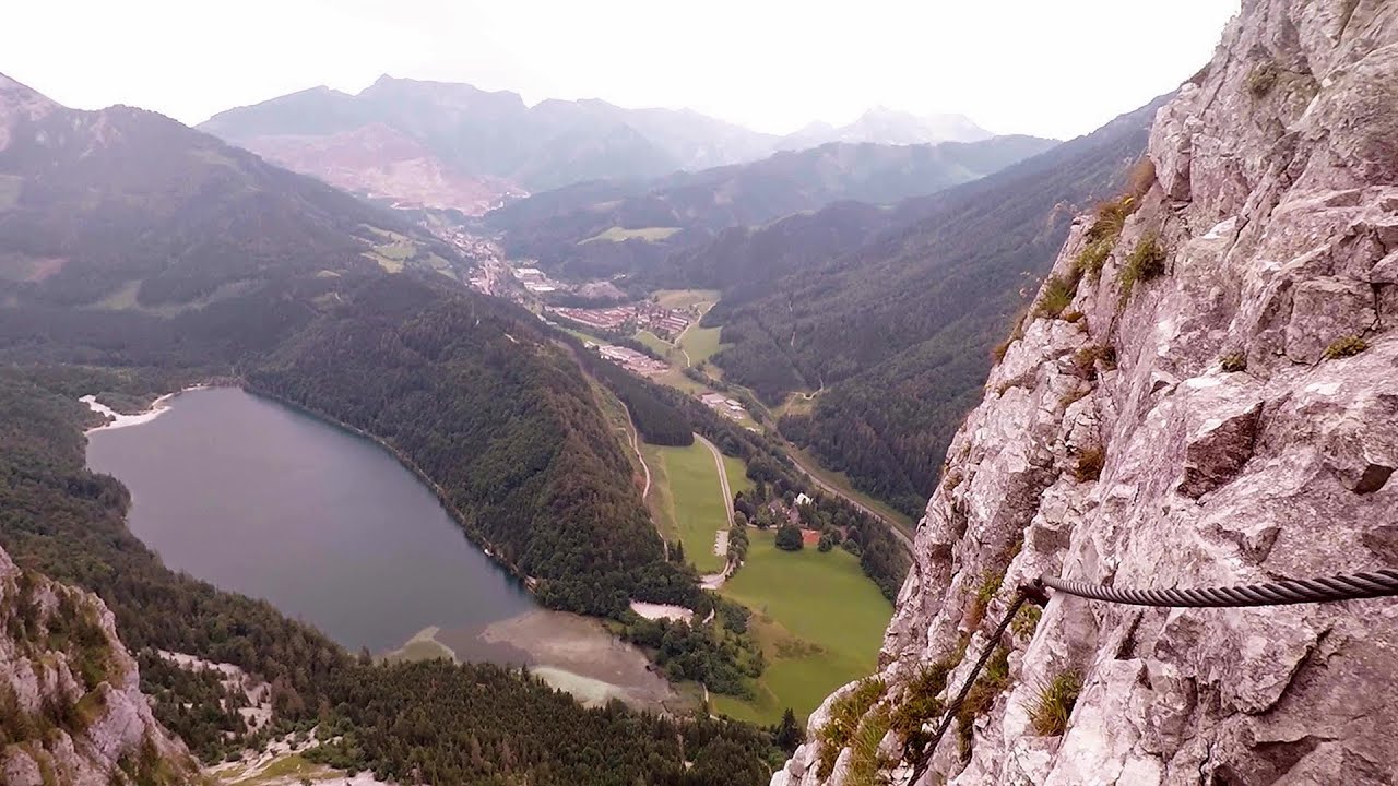
Kaiser Franz-Josef Klettersteig - Leopoldsteiner See 228.87 km away
The Franz-Josef Klettersteig is located on the Seemauer cliff face, which rises 900 meters above Leopoldsteiner Lake, in the western part of the Hochschwab mountain range, just 4 km from the town of Eisenerz. This via ferrata is named after the Kaisersteig, a hunting trail established for the esteemed Emperor Franz Joseph I of Austria and Hungary at the end of the 19th century, traces of which can still be observed today.
Other places
Wild Ferenc memorial path Suhardul Mic 602.27 km away
In recent days, this news has been everywhere: the via ferrata route built on the southwest wall of Suhardul Mic (Little Suhard) has finally been completed and inaugurated. The new route has been named after Ferenc Wild, in memory of the former mountain rescuer, sports writer, and one of the founders of the mountain rescue association in Gheorgheni.
In recent days, this news has been everywhere: the via ferrata route built on the southwest wall of Suhardul Mic (Little Suhard) has finally been completed and inaugurated. The new route has been named after Ferenc Wild, in memory of the former mountain rescuer, sports writer, and one of the founders of the mountain rescue association in Gheorgheni.
The Bear's Jump iron path Baia de Fier 511.41 km away
The Bear's Jump (Saritoarea Ursului) is a fantasy-named via ferrata that opened in May 2018 near Baia de Fier, alongside the Middle Belt (Spirala Medie). Both routes begin from the G zone of the rock face that conceals the Women's Cave (Pestera Muierilor).
The Bear's Jump (Saritoarea Ursului) is a fantasy-named via ferrata that opened in May 2018 near Baia de Fier, alongside the Middle Belt (Spirala Medie). Both routes begin from the G zone of the rock face that conceals the Women's Cave (Pestera Muierilor).
Fairy Cliff (Peretele Zanelor) via ferrata route Vadu Crisului 353.04 km away
In Vadu Crisului, in the Padurea Craiului Mountains, on the right bank of the Crisul Repede, you can find the newest, in chronological order (2015) the fifth Transylvanian, new type of via ferrata route. I will not count here the traditional iron paths, the high-mountain hiking trails, partly secured with iron cables, or the rock canyons with iron ladders and footbridges.
In Vadu Crisului, in the Padurea Craiului Mountains, on the right bank of the Crisul Repede, you can find the newest, in chronological order (2015) the fifth Transylvanian, new type of via ferrata route. I will not count here the traditional iron paths, the high-mountain hiking trails, partly secured with iron cables, or the rock canyons with iron ladders and footbridges.
Siklós castle 169.75 km away
The Siklós Castle is an important historical landmark in Hungary, its fortress walls were laid around 1260, with the first written record dating back to 1294. The fortification, built on a low elevation, features an inner tower, an irregular floor plan, and consists of both an outer and an inner fortress.
The Siklós Castle is an important historical landmark in Hungary, its fortress walls were laid around 1260, with the first written record dating back to 1294. The fortification, built on a low elevation, features an inner tower, an irregular floor plan, and consists of both an outer and an inner fortress.
Aareschlucht Meiringen-Innertkirchen, Switzerland 735.2 km away
The Aareschlucht is a 1400-meter long, 200-meter deep gorge of the Aare river, near Innertkirchen, Switzerland. It has two entrances, one from Meiringen in the west, and one from Innertkirchen in the east, which lead into the narrow, but stunning gorge.
The Aareschlucht is a 1400-meter long, 200-meter deep gorge of the Aare river, near Innertkirchen, Switzerland. It has two entrances, one from Meiringen in the west, and one from Innertkirchen in the east, which lead into the narrow, but stunning gorge.
[ Top ↑ ]
[ Top ↑ ]
Copyright © 2003-2025 Trekkingklub and friends. Reproduction of any text, picture or video from this website, either in printed or electronic form, is prohibited without prior written permission. The given distances are to be understood as straight line distances, and are approximate. Website made in Miercurea Ciuc  .
.