Kaya Bunar (Hotnishki Vodopadi, Hotnitsa Waterfall) - Hotnitsa - video

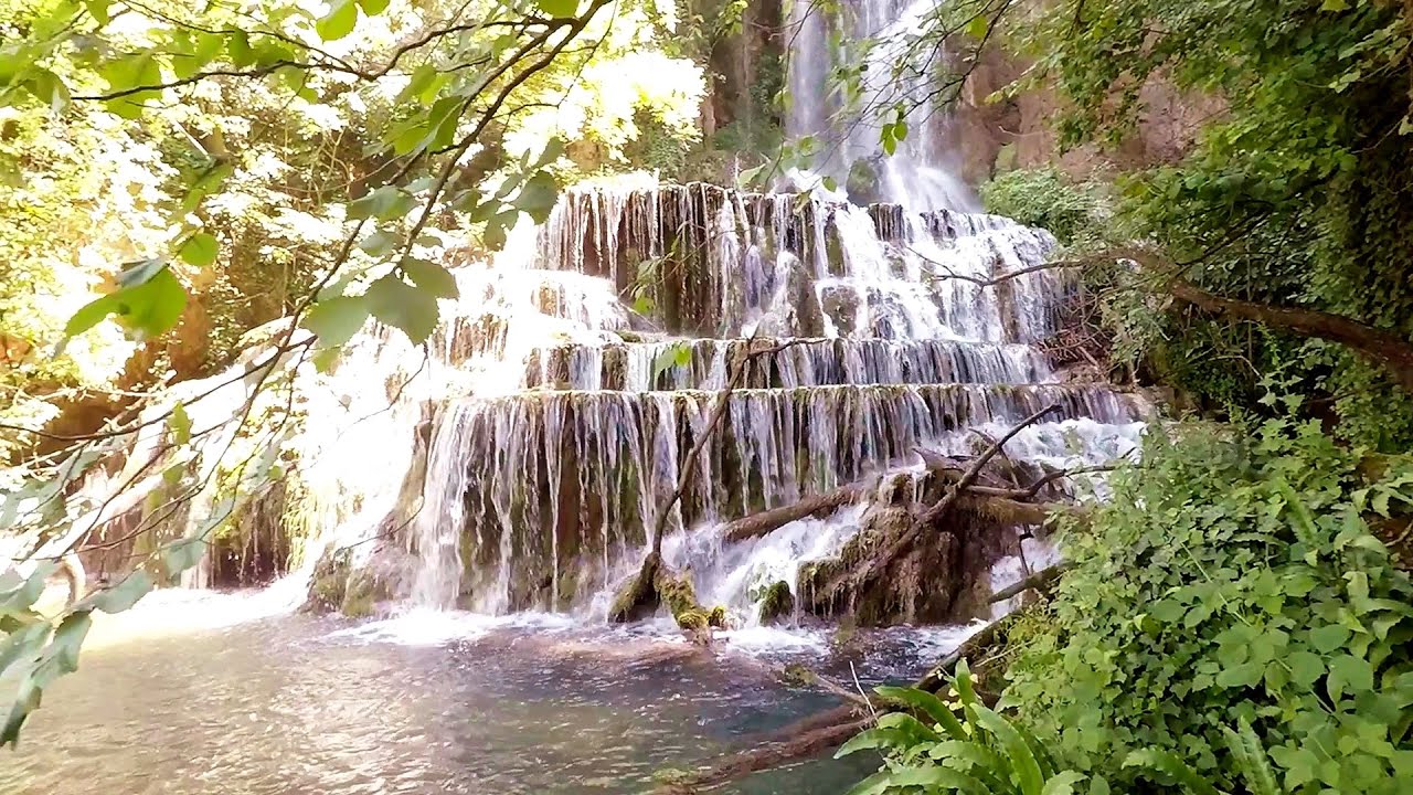
The Kaya Bunar Waterfall (Hotnishki Vodopadi) is located 20 km from the city of Veliko Tarnovo in Bulgaria. The waterfall is 30 meters high, and there are several smaller cascades above it. Below, a picturesque little pond has formed. You can drive quite close to the waterfall. In the clearing in front, there are wooden tables and benches waiting for those who wish to relax.
Read more
Filmed with GoPro HERO5 Black. Music: The Fresh Monday by Dexter Britain. Copyright © 2017 - 2025 Geo Trekker Videos.
Already published 8162 photos and 136 videos. Please register for full access.
Photos of nearby places


Canyon of Waterfalls eco-trail - Smolyan (8 photos) 188.06 km away
The Soskovcheto Reserve was established in 1968 and covers an area of 177 hectares. It is situated in the Perelishko-Prespanski region of the Rhodope Mountains.
[ Top ↑ ]
Videos of nearby places
Krushuna waterfalls - Krushuna 40.48 km away
The Krushuna Waterfalls are a series of karst cascades formed in travertine. They are located near the village of Krushuna, not far from the town of Lovech, and are Bulgaria's largest waterfall of this type.

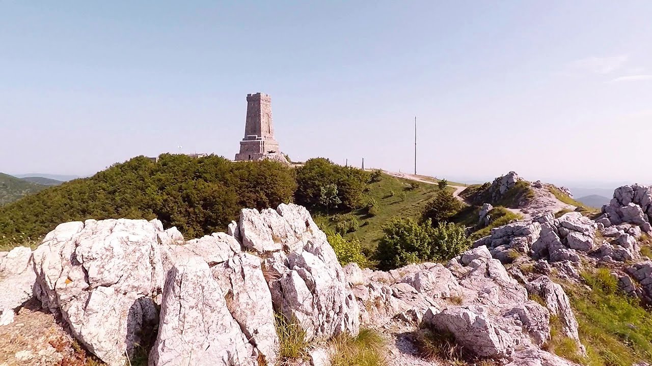
Buzludzha monument - Kazanluk 46.61 km away
Buzludzha is a historically significant mountain located in the Central Balkan Mountains of Bulgaria. At its summit, at an altitude of 1432 meters above sea level, there is an abandoned monument.
Shipka pass - Shipka 46.9 km away
The Shipka Pass is one of the most spectacular crossings of the Balkan Mountains, and is part of the Bulgarka Nature Park. It separates the provinces of Gabrovo and Stara Zagora, and provides a connection between the cities of Gabrovo and Kazanlak.
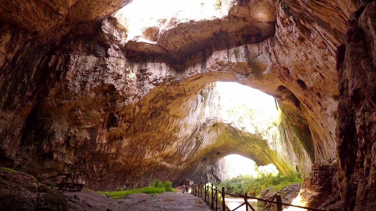
Devetashka cave - Devetaki 51.93 km away
The Devetashka Cave is located in Bulgaria, near the village of Devetaki. After the entrance portal, which measures 30 m by 35 m, there is a vast open chamber that is 110 meters wide and 359 meters long.
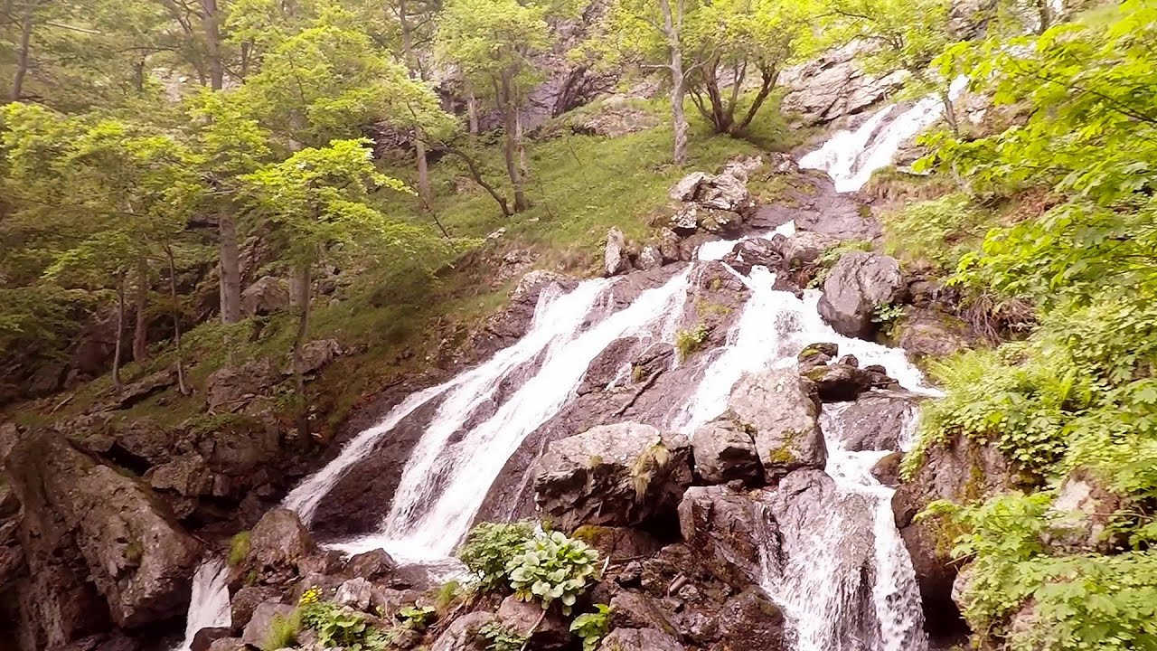
Babsko Praskalo waterfall - Tazha 62 km away
In the Central Balkans National Park, there are many rivers that cascade down spectacular waterfalls, which the locals call praskalo. One of the smallest waterfalls in the area is Babsko Praskalo, which stands at only 54 meters high.
Other places
Hili cove iron path Turda Gorges 406.82 km away
While the first time I climbed this via ferrata in the morning, now I climbed it in the light of the setting sun. The red-dressed rocks created a special atmosphere, and I could admire the sunset from the top of the climbing route.
While the first time I climbed this via ferrata in the morning, now I climbed it in the light of the setting sun. The red-dressed rocks created a special atmosphere, and I could admire the sunset from the top of the climbing route.
Bolii Cave Banita 310.43 km away
The Bolii Cave is located 6 km north of Petrosani, on the road that connects Hateg with the Jiu Valley. Here, the railway line that connects the two parts of Hunedoara County passes through, featuring a total of 66 curves and 8 tunnels.
The Bolii Cave is located 6 km north of Petrosani, on the road that connects Hateg with the Jiu Valley. Here, the railway line that connects the two parts of Hunedoara County passes through, featuring a total of 66 curves and 8 tunnels.
Via ferrata Rio Sallagoni Drena, Italia 1195.17 km away
The surrounding iron climbing routes are located on rock walls exposed to a scorching sun. But the Rio Sallagoni via ferrata goes upwards in a pleasantly cool gorge, above the creek and waterfalls, and eventually reaches the Drena Castle.
The surrounding iron climbing routes are located on rock walls exposed to a scorching sun. But the Rio Sallagoni via ferrata goes upwards in a pleasantly cool gorge, above the creek and waterfalls, and eventually reaches the Drena Castle.
Trümmelbach-fälle Lauterbrunnen, Switzerland 1435.19 km away
The Trümmelbach Waterfalls are a series of ten cascades partially located inside the belly of the mountain, near Lauterbrunnen, Switzerland. Infrastructure has been established to enable tourist access to the waterfalls.
The Trümmelbach Waterfalls are a series of ten cascades partially located inside the belly of the mountain, near Lauterbrunnen, Switzerland. Infrastructure has been established to enable tourist access to the waterfalls.
The Devil's Iron Path Aussois, Savoy, Rhône Alps 1511.19 km away
The Devil's Iron Path (Via ferrata du Diable) is a multi-part via ferrata, located above a spectacular waterfall (Cascade du Nant), in a gorge, below the Victor-Emmanuel fort. For me, this climbing route presented the greatest challenge so far (2015).
The Devil's Iron Path (Via ferrata du Diable) is a multi-part via ferrata, located above a spectacular waterfall (Cascade du Nant), in a gorge, below the Victor-Emmanuel fort. For me, this climbing route presented the greatest challenge so far (2015).
[ Top ↑ ]
[ Top ↑ ]
Copyright © 2003-2025 Trekkingklub and friends. Reproduction of any text, picture or video from this website, either in printed or electronic form, is prohibited without prior written permission. The given distances are to be understood as straight line distances, and are approximate. Website made in Miercurea Ciuc  .
.