Loreley and Pink Panther iron path - Baia de Fier - video

Loreley and Pink Panther iron path - Baia de Fier - videoPlay
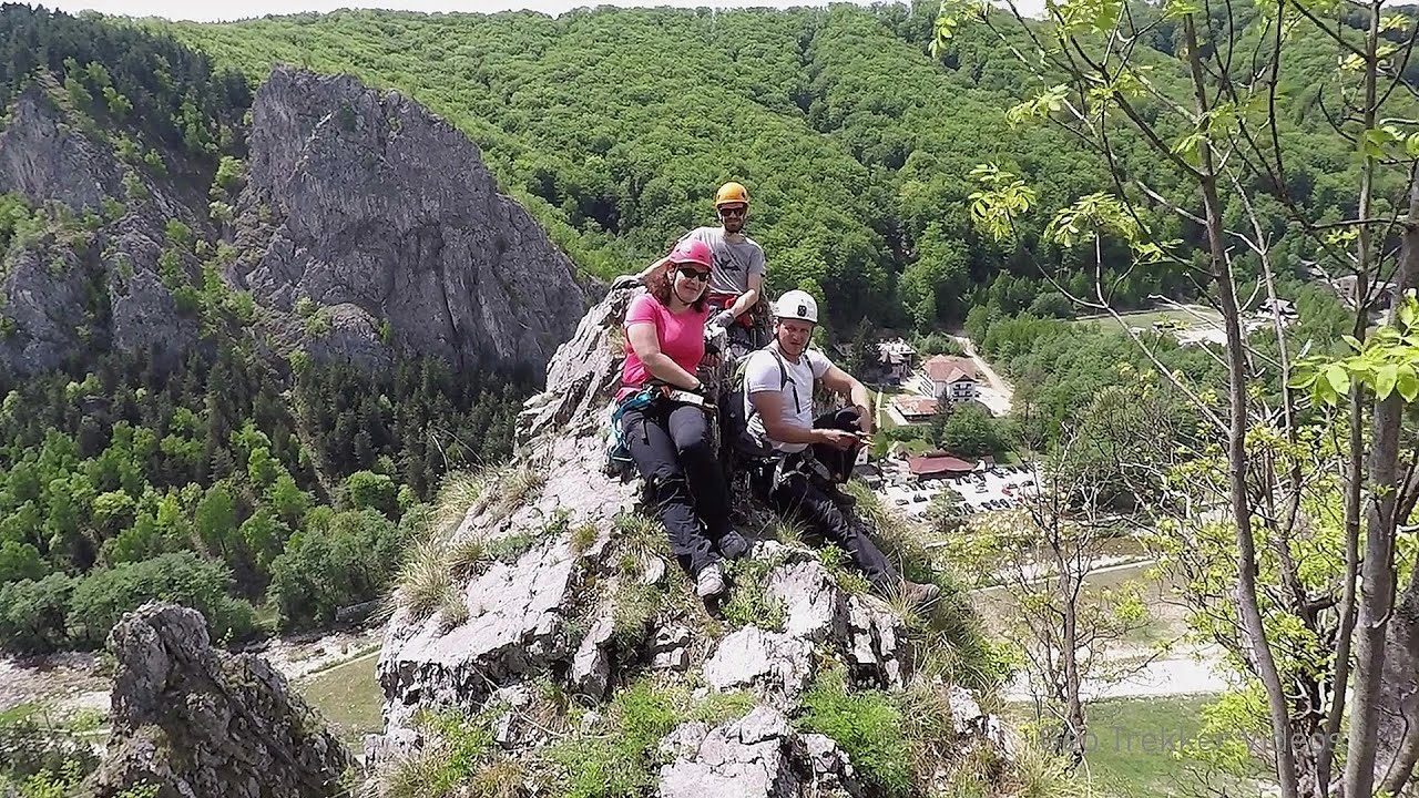
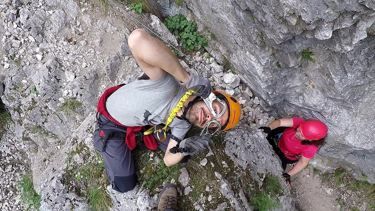
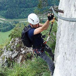
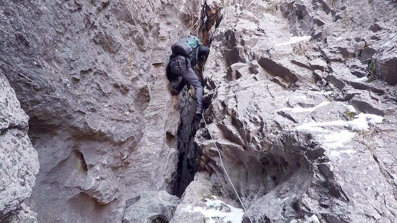
The Loreley via ferrata (graded B/C, with an elevation difference of approximately 100 m and a length of about 100 m) is located on the rock wall on the opposite side of the road. A branch from its upper section leads to the Pink Panther (Pantera Roz, graded A/B/C, approximately 200 meters long, with an elevation difference of about 50 meters).

On that day, we also had a conversation with the creator of these via ferratas, who mentioned that detailed information about these iron paths would only be provided at some point in the future. At first glance, it is challenging to accurately assess the precise length and elevation differences of these routes. Therefore, please take the data I have provided with caution.

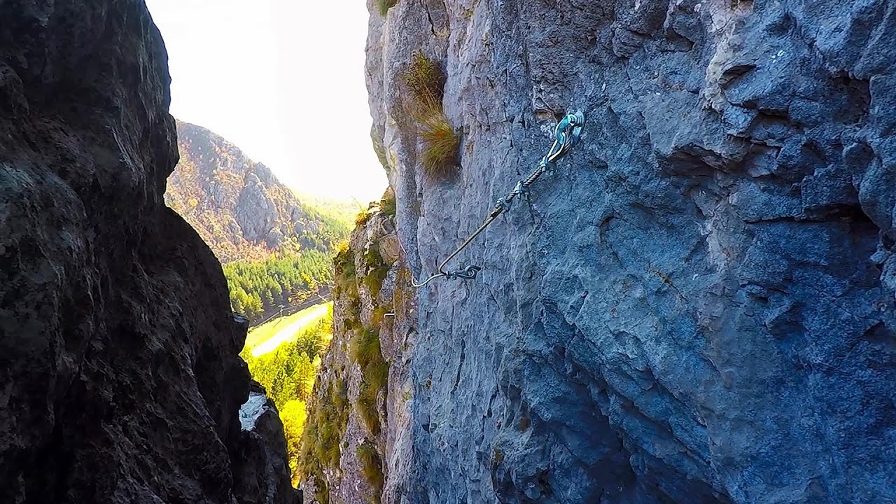
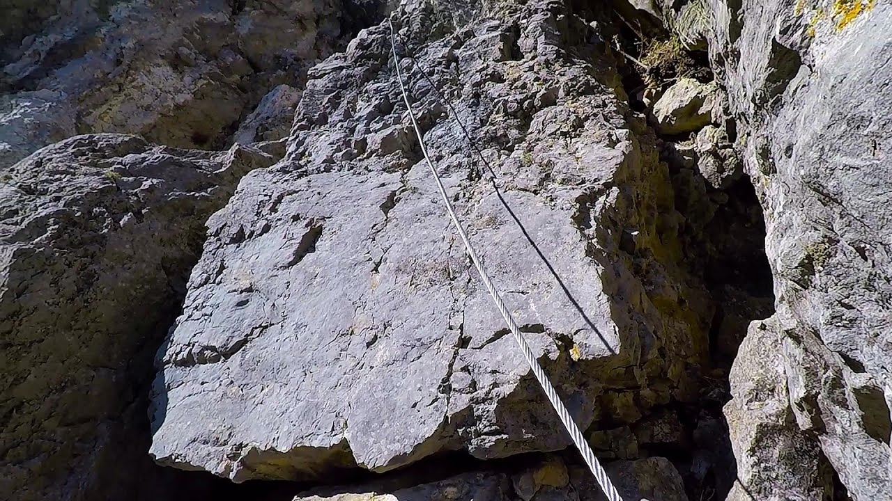
The Loreley route is actually the initial section of the hiking trail marked with blue dot and blue cross, which ascends to the ridge between the Galbenul and Oltet gorges. A 6 mm, very loosely secured iron wire assists with the ascent. Caution is advised: during heavy rains, water cascades down here like a waterfall, creating dangerous climbing conditions.

The Loreley is a 132 m high rock near Sankt Goarshausen in Germany, located along the Rhine. According to local legends, the siren Loreley enchanted sailors with her beauty and voice, leading them into trouble in this perilous spot. This legend has been immortalized in the works of Heinrich Heine, Jeno Dsida, and Sandor Weores. This is the origin of the name for the Loreley route, although the via ferrata itself did not captivate us to the same extent.

The Pink Panther (the section completed thus far, leading up to the caves) is also an easy route. Its line is unusual in places, mostly horizontal, and the wire is somewhat tighter in this section. Its uniqueness lies in the rock caves and passages found at the end of the short route, making it a great spot for photography and offering a spectacular view of the Galbenul Gorge and the rock wall of the Muierii Cave across from it.

Though we were continuously taking photographs and filming the sunset while climbing, we still managed to reach one of the high points on the ridge. Following the red dot north, we took a longer detour. However, descending via the via ferrata is easier and faster. In the future, it would certainly be worthwhile to continue further along the ridge to the viewpoints above the Oltet Gorge, the Ursache Cross, and Sura Haiducilor.
[ Hu ] - [ Ro ] - Via ferrata - Parang Mountains
15th February 2017. Filmed with GoPro HERO5 Black. Music: Melancholy Aftersounds by Kai Engel. Copyright © 2017 - 2024 Geo Trekker Videos.
Already published 8093 photos and 90 videos. Please register for full access.

Photos of nearby places

Muierii cave - Parang Mountains
Muierii cave - Parang Mountains (1st December 2003 - 11 photos) 0.26 km away
The Muierii Cave is situated at the southern foot of the Parang Mountains in the Baia de Fier area of Gorj County. Numerous climbing routes have been established on the rocks above the cave and on the opposite side of the road.
Polovragi cave - Capatinei Mountains
Polovragi cave - Capatinei Mountains (1st December 2003 - 6 photos) 2.24 km away
King's Road - Ranca holiday resort
King's Road - Ranca holiday resort (14th August 2011 - 16 photos) 20.72 km away
Parangul Mare peak
Parangul Mare peak (30th August 2020 - 16 photos) 23.61 km away
Goat saddle, Carja mountain shelter - Carja peak - Stoienita peak - Gemanarea - Parangul Mare peak.
Round rocks from Costesti
Round rocks from Costesti (1st May 2013 - 16 photos) 25.25 km away
Goats Trail, Cheii Gorges
Goats Trail, Cheii Gorges (13th June 2010 - 40 photos) 29.98 km away
Doabra Snail Shells - Brezoi
Doabra Snail Shells - Brezoi (18th September 2017 - 12 photos) 42.06 km away
Doabra Valley - Calinesti-Brezoi forest - Lotru Valley, Cozia National Park.
[ Top ↑ ]

Videos of nearby places

Spirala Medie iron path - Baia de Fier 0.22 km away
In May 2018, two new via ferrata routes were inaugurated in Baia de Fier. Both start from section G of the rock face hiding the Muierilor Cave, and their initial stages are shared. The Bear's Jump (in Romanian, Saritoarea Ursului) leads vertically upwards. The Middle Belt or Middle Spiral (in Romanian, Spirala Medie) connects the former to the Big Spiral via ferrata route.
The Bear's Jump iron path - Baia de Fier 0.24 km away
The Bear's Jump (in Romanian, Saritoarea Ursului) is a fantasy-named via ferrata that opened in May 2018 near Baia de Fier, alongside the Middle Spiral (in Romanian, Spirala Medie). Both routes begin from the G zone of the rock face that conceals the Muierilor Cave.
Womens Spiral, Cave Ridge, and The Great Crack iron paths - Baia de Fier 0.25 km away
Perhaps the most interesting via ferrata among the routes in the Baia de Fier area is the Womens Spiral. After completing it, I can say that it is the second most thrilling via ferrata in Romania, following the Big Via Ferrata at Rasnov.
Muierii Cave - Baia de Fier 0.26 km away
We visited the Baia de Fier area, and climbed on the rock that also conceals the Women's Cave (Pestera Muierilor). Between two via ferrata routes, we also participated in one of the guided cave tours, which depart every hour.

Other videos

Skaklya waterfall Vratsa 224.21 km away
The largest seasonal waterfall in Bulgaria plunges down from a height of 141 meters. It is located in the Vratsa Mountain National Park, just one and a half kilometers away from the city of Vratsa. The waterfall can be accessed via a well-marked trail and is most stunning after snowmelt or rainfall. Climbing to the top of the waterfall offers a breathtaking view of the city.
Schulter Anstieg klettersteig Hoher Dachstein, Austria 818.57 km away
Two iron paths lead to the top of the Hoher Dachstein. The Randkluft is shorter, but can only be reached through a glacier with cracks. It is dangerous to reach the starting point, that's probably why it was closed now.
Muierii Cave Baia de Fier 0.26 km away
We visited the Baia de Fier area, and climbed on the rock that also conceals the Women's Cave (Pestera Muierilor). Between two via ferrata routes, we also participated in one of the guided cave tours, which depart every hour.
Snow-covered valley of Balea and the Transfagarasan in winter The ascent 82.68 km away
The Fagarasi Mountains can be easily approached from the north, mainly by using the Transfagarasan Road. This road is only accessible during the summer months (throughout its entire length), but from the Balea Waterfall station (Statia Balea Cascada) you can also reach the Balea Lake by cable car.
Oltet Gorges Capatanii Mountains 2.19 km away
That day, we had planned to ski at the Ranca resort, situated alongside the Transalpina road in the Parang Mountains. Unfortunately, the minimal snowfall made skiing unfeasible, so we had to find an alternative activity on our way home.
L'Escale á Peille iron path Alpes-Maritimes, France 1303.81 km away
One of the challenging via ferratas in the Maritime Alps is the L'Escale a Peille. One of its elements is a steel cobweb, where you can feel like you're hanging in the air.
Les Gorges de la Méouge France 1419.6 km away
Following today's climb, I experienced the soothing pleasure of immersing myself in the turquoise waters of the Méouge creek, in the pond beneath a waterfall. If you find yourself in Sisteron or Grenoble, do not miss the opportunity to explore the magnificent Méouge valley near Ribiers. And do not leave your swimwear behind.
Byala Reka eco-trail Kalofer 297.92 km away
The Byala Reka eco-trail is situated at the foot of the Stara Planina mountain range, 8 km from the town of Kalofer. A 1,830-meter-long hiking trail has been established along the White Creek within the Central Balkan National Park. It can be explored via a circular route that takes about 2 hours to complete. The trail features numerous wooden bridges, railings, viewpoints, resting areas, and information panels.
Via ferrata Rocher de l'envers France 1390.09 km away
The Rocher de l'envers via ferrata is located in a beautiful environment, above Saint-Vincent-de-Mercuze, in France. Several beautiful and large waterfalls, as well as several small cascades, make it attractive.
Rieseneishöhle Dachstein Salzkammergut, Austria 812.34 km away
The second cave open to the public, of Schönbergalm above Obertraun am Hallstättersee, is the Ice Cave (Rieseneishöhle). For me, it was more spectacular than the Mammoth Cave.
Loreley and Pink Panther iron path Baia de Fier 0 km away
The Loreley via ferrata (graded B/C, with an elevation difference of approximately 100 m and a length of about 100 m) is located on the rock wall on the opposite side of the road. A branch from its upper section leads to the Pink Panther (Pantera Roz, graded A/B/C, approximately 200 meters long, with an elevation difference of about 50 meters).
Stan Valley Canyon in winter 68.84 km away
The Stan Valley is a picturesque canyon, even in winter. In fact, when the stream is frozen and covered with a layer of snow, exploring the canyon becomes much quicker and easier. During this time, we can also access areas that were unreachable in the summer, due to high water levels.
Iron path Harghita-Madaras 198.34 km away
Amateur filming in Harghita-Madaras, holding the camera by hand in the car, and helmet-mounted on the via ferrata. I climbed an iron path for the first time in my life on the Nyerges cliffs (Stancile Seii), I didn't have the right equipment yet. That's where I fell in love with climbing.
Waterfalls of Lapos creek Bicaz Gorges 240.04 km away
One of the lesser-known attractions of the Bicaz Gorges is the series of waterfalls along Lapos Creek. This creek flows between Cupas Stone and Bardos Stone before eventually merging with Bicaz Creek, forming spectacular waterfalls beneath the Altar Stone.
Iron path in winter Harghita Madaras 198.36 km away
This is already the sixth time I've climbed the via ferrata route set up on the rocky cliffs of Seii Peak near Harghita Madaras. Although the forecast suggests that the weather should be nice, I am greeted by a sky covered in clouds.
[ Top ↑ ]
[ Top ↑ ]
Copyright © 2003-2024 Trekkingklub and friends. Reproduction of any text, picture or video from this website, either in printed or electronic form, is prohibited without prior written permission. Nearby settlements: Baia de Fier 2.46 km away, Tourist attractions near Baia de Fier 2.46 km away. The given distances are to be understood as straight line distances, and are approximate. Website made with love Made with love in Miercurea Ciuc.