Black Valley - Eagles Lake - photos


Page no. 1, photos: 1-6, 36 photos in total. >>>

Copyright © 2010 - 2025 Trekkingklub.com.
Already published 8162 photos and 136 videos. Please register for full access.
Photos of nearby places


Devil's Hand Rock - Ciucas Mountains (30 photos) 12.71 km away
Dalghiu - Devil's Hand Rock - Ciucas peak - Vama Buzaului


[ Top ↑ ]
Videos of nearby places
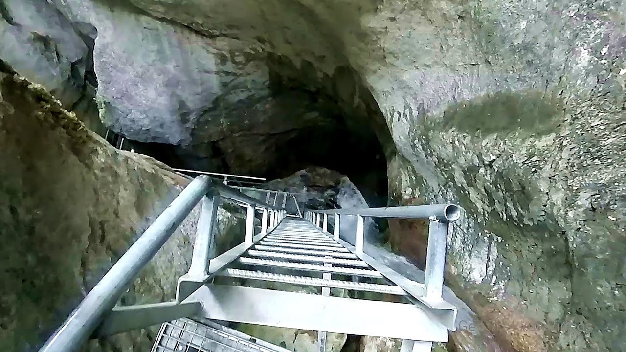
Seven Ladder Canyon and Waterfall - Piatra Mare Mountain 38.39 km away
The Seven Ladder Gorge is the largest and most spectacular gorge in the Piatra Mare massif. The narrow canyon has a length of 160 meters, and over a drop of 58 meters includes 7 bigger and several smaller waterfalls.
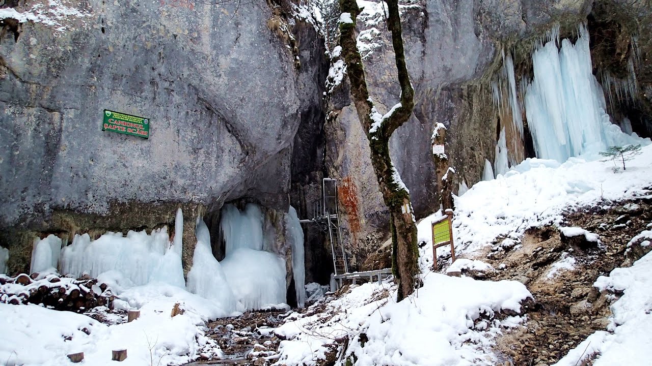
Seven Ladder Canyon in Winter - Piatra Mare Mountain 38.48 km away
Seven Ladder Canyon and Waterfall in Winter - Piatra Mare Mountain
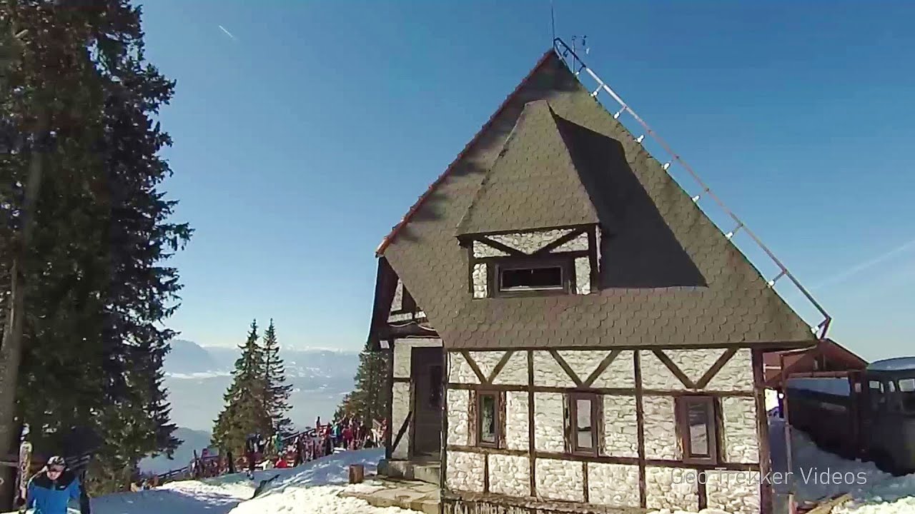
Ski resort - Poiana Brasov - Postavarul Mountains 45.39 km away
Shining sun and an Austria-feeling on the impeccable slopes of the ski paradise Poiana Brasov above Brasov. Sunbathing, coffee and refreshing drinks on the terrace of Julius Römer chalet.
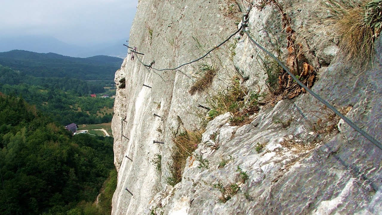
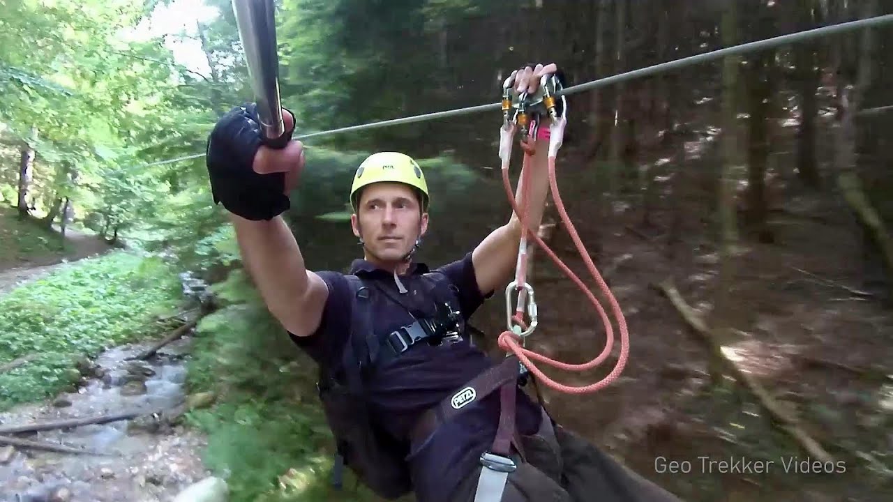
Big Via ferrata Rasnoavei Gorges 47.96 km away
The most dangerous Eastern European iron path, and also one of the most beautiful via ferrata routes in Romania, is in the Rasnoavei Gorges, Postavaru Mountains.The route is 450 m long, with a level difference of 220 m.
Other places
Krushuna waterfalls Krushuna 267.56 km away
The Krushuna Waterfalls are a series of karst cascades formed in travertine. They are located near the village of Krushuna, not far from the town of Lovech, and are Bulgaria's largest waterfall of this type.
The Krushuna Waterfalls are a series of karst cascades formed in travertine. They are located near the village of Krushuna, not far from the town of Lovech, and are Bulgaria's largest waterfall of this type.
Canyon of Waterfalls Smolyan 453.77 km away
The eco-trail known as the Canyon of Waterfalls is located in Bulgaria, within the Rhodope Mountains and the Soskovcheto Nature Reserve. It begins at the edge of the Sredoka suburb of the city of Smolyan.
The eco-trail known as the Canyon of Waterfalls is located in Bulgaria, within the Rhodope Mountains and the Soskovcheto Nature Reserve. It begins at the edge of the Sredoka suburb of the city of Smolyan.
Borov Kamak waterfall Zgorigrad, Vratsa 336 km away
The Vratsa eco-trail starts from the village of Zgorigrad, located 6 km from the city of Vratsa in Bulgaria, and ends at the Parshevitza hut. It is also known as the Zgorigradska or Borov Kamak eco-trail.
The Vratsa eco-trail starts from the village of Zgorigrad, located 6 km from the city of Vratsa in Bulgaria, and ends at the Parshevitza hut. It is also known as the Zgorigradska or Borov Kamak eco-trail.
Natural stone bridge Aglen 295.73 km away
[ Top ↑ ]
[ Top ↑ ]
Copyright © 2003-2025 Trekkingklub and friends. Reproduction of any text, picture or video from this website, either in printed or electronic form, is prohibited without prior written permission. Nearby settlements: Gura Siriului 5.97 km away, Tourist attractions near Vama Buzaului 13.86 km away. The given distances are to be understood as straight line distances, and are approximate. Website made in Miercurea Ciuc  .
.