Isuica (Iszulyka) Valley - Becheci (Bekecs) Peak - photos


Page no. 1, photos: 1-6, 12 photos in total. >>>

Copyright © 2010 - 2025 Trekkingklub.com.
Already published 8178 photos and 136 videos. Please register for full access.
Photos of nearby places


[ Top ↑ ]
Videos of nearby places

Hot air balloon parade 2015 - Campu Cetatii 6.87 km away
This year, the Hot Air Balloon Parade was organized in Campu Cetatii for the tenth time. Unfortunately, the weather only allowed for flying on Saturday morning and evening.
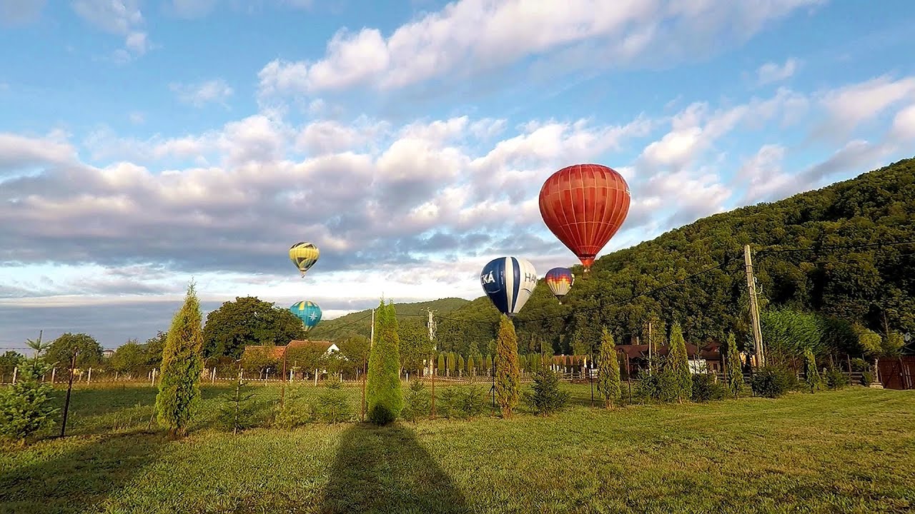
Hot Air Balloon Parade 2018 - Campu Cetatii 6.87 km away
This year, the hot air balloons flew low over Campu Cetatii. The weather did not really favor the parade.

The Heart of Jesus look-out - Lupeni 33.36 km away
Through the mud on Gordon Mountain, above Farkaslaka (Lupeni commune, Harghita county, Transilvania), on a cloudy afternoon, at the end of February. The destination is the Heart of Jesus lookout, nicknamed as Pléhkrisztus (The Tin Christ).

Iron path - Harghita-Madaras 49.38 km away
Amateur filming in Harghita-Madaras, holding the camera by hand in the car, and helmet-mounted on the via ferrata. I climbed an iron path for the first time in my life on the Nyerges cliffs (Stancile Seii), I didn't have the right equipment yet.

Iron path in winter - Harghita Madaras 49.4 km away
This is already the sixth time I've climbed the via ferrata route set up on the rocky cliffs of Seii Peak near Harghita Madaras. Although the forecast suggests that the weather should be nice, I am greeted by a sky covered in clouds.
Other places
Leopoldsteiner lake Eisenerz, Steiermark 771.56 km away
Leopoldsteiner See is located in Styria, 4 km northwest of the town of Eisenerz. It lies at an elevation of 628 meters above sea level in the western part of the Hochschwab mountain range, at the foot of the Seemauer cliff.
Leopoldsteiner See is located in Styria, 4 km northwest of the town of Eisenerz. It lies at an elevation of 628 meters above sea level in the western part of the Hochschwab mountain range, at the foot of the Seemauer cliff.
Billy-goat lake, Closed Gates Retezat Mountains 209.02 km away
The most unique ridge trail of the Retezat Mountains is the Closed Gates.Below, at an altitude of 2070 m above sea level, is the Billy-goat lake.
The most unique ridge trail of the Retezat Mountains is the Closed Gates.Below, at an altitude of 2070 m above sea level, is the Billy-goat lake.
Dyavolski Most (Devil's Bridge) Ardino 555.32 km away
The Devil's Bridge (Dyavolski Most, in Turkish Sheytan Kyupriya) is located in the gorge of the Arda River, just north of the town of Ardino in Bulgaria. It was constructed in the early 16th century, between 1515 and 1518, by an architect named Dimitar, on the remains of an earlier Roman bridge.
The Devil's Bridge (Dyavolski Most, in Turkish Sheytan Kyupriya) is located in the gorge of the Arda River, just north of the town of Ardino in Bulgaria. It was constructed in the early 16th century, between 1515 and 1518, by an architect named Dimitar, on the remains of an earlier Roman bridge.
Zip-line near Seven Ladder Canyon Piatra Mare Mountain 126.34 km away
L'Escale á Peille iron path Maritime Alps, France 1407.15 km away
One of the challenging via ferratas in the Maritime Alps is the l'Escale a Peille. One of its elements is a steel cobweb, where you can feel like you're hanging in the air.
One of the challenging via ferratas in the Maritime Alps is the l'Escale a Peille. One of its elements is a steel cobweb, where you can feel like you're hanging in the air.
[ Top ↑ ]
[ Top ↑ ]
Copyright © 2003-2025 Trekkingklub and friends. Reproduction of any text, picture or video from this website, either in printed or electronic form, is prohibited without prior written permission. Nearby settlements: Silea Nirajului 3.28 km away, Tourist attractions near Eremitu 6.01 km away. The given distances are to be understood as straight line distances, and are approximate. Website made in Miercurea Ciuc  .
.