Siclod Stone - Gurghiu Mountains - photos


Page no. 1, photos: 1-6, 8 photos in total. >>>

Copyright © 2011 - 2025 Trekkingklub.com.
Already published 8162 photos and 136 videos. Please register for full access.
Photos of nearby places


The Rock with a Hole - Corund (6 photos) 14.81 km away
The Likas Stone (The Rock with a Hole) is located near Korond (Corund), on a meadow next to the road and four graves. In the middle of the conglomerate rock block, there is a perfectly drilled, heart-shaped hole.

[ Top ↑ ]
Videos of nearby places

Hot air balloon parade 2015 - Campu Cetatii 15.68 km away
This year, the Hot Air Balloon Parade was organized in Campu Cetatii for the tenth time. Unfortunately, the weather only allowed for flying on Saturday morning and evening.
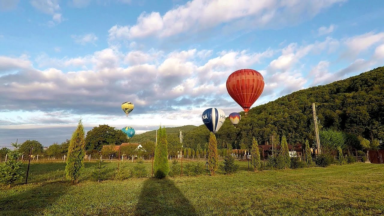
Hot Air Balloon Parade 2018 - Campu Cetatii 15.68 km away
This year, the hot air balloons flew low over Campu Cetatii. The weather did not really favor the parade.

The Heart of Jesus look-out - Lupeni 21.54 km away
Through the mud on Gordon Mountain, above Farkaslaka (Lupeni commune, Harghita county, Transilvania), on a cloudy afternoon, at the end of February. The destination is the Heart of Jesus lookout, nicknamed as Pléhkrisztus (The Tin Christ).

Iron path - Harghita-Madaras 39.47 km away
Amateur filming in Harghita-Madaras, holding the camera by hand in the car, and helmet-mounted on the via ferrata. I climbed an iron path for the first time in my life on the Nyerges cliffs (Stancile Seii), I didn't have the right equipment yet.

Iron path in winter - Harghita Madaras 39.5 km away
This is already the sixth time I've climbed the via ferrata route set up on the rocky cliffs of Seii Peak near Harghita Madaras. Although the forecast suggests that the weather should be nice, I am greeted by a sky covered in clouds.
Other places
Siega via ferrata Silberkar Gorge, Ramsau am Dachstein 866.06 km away
The Siega via ferrata, categorized as a C/D level of difficulty, is perhaps the least interesting of the three via ferrata routes in the Silberkar Gorge (Silberkarklamm). This doesn't mean that it's not good, just that the other two are even better.
The Siega via ferrata, categorized as a C/D level of difficulty, is perhaps the least interesting of the three via ferrata routes in the Silberkar Gorge (Silberkarklamm). This doesn't mean that it's not good, just that the other two are even better.
Hili cove iron path Turda Gorges 105.77 km away
While the first time I climbed this via ferrata in the morning, now I climbed it in the light of the setting sun. The red-dressed rocks created a special atmosphere, and I could admire the sunset from the top of the climbing route.
While the first time I climbed this via ferrata in the morning, now I climbed it in the light of the setting sun. The red-dressed rocks created a special atmosphere, and I could admire the sunset from the top of the climbing route.
Black Rocks iron path Bihor Mountains 185.83 km away
Black Rocks is located in the Bihor Mountains, near the Vartop Saddle, to the west of it. It is interesting that the locals (if I understood correctly) do not know this name, but use the name Piatra Buna (meaning Good Stone) for this spectacular rock.
Black Rocks is located in the Bihor Mountains, near the Vartop Saddle, to the west of it. It is interesting that the locals (if I understood correctly) do not know this name, but use the name Piatra Buna (meaning Good Stone) for this spectacular rock.
The Devil's Iron Path Aussois, Savoy, Rhône Alps 1422.77 km away
The Devil's Iron Path (Via ferrata du Diable) is a multi-part via ferrata, located above a spectacular waterfall (Cascade du Nant), in a gorge, below the Victor-Emmanuel fort. For me, this climbing route presented the greatest challenge so far (2015).
The Devil's Iron Path (Via ferrata du Diable) is a multi-part via ferrata, located above a spectacular waterfall (Cascade du Nant), in a gorge, below the Victor-Emmanuel fort. For me, this climbing route presented the greatest challenge so far (2015).
Cherven, a medieval fortified town Bulgaria 332.14 km away
Located about 30 km south of the city of Ruse in Bulgaria, the Cherven medieval fortress can be found in the Rusenski Lom Nature Park. Originally a Byzantine fortification from the 6th century, it reached the height of its development in the 14th century.
Located about 30 km south of the city of Ruse in Bulgaria, the Cherven medieval fortress can be found in the Rusenski Lom Nature Park. Originally a Byzantine fortification from the 6th century, it reached the height of its development in the 14th century.
[ Top ↑ ]
[ Top ↑ ]
Copyright © 2003-2025 Trekkingklub and friends. Reproduction of any text, picture or video from this website, either in printed or electronic form, is prohibited without prior written permission. Nearby settlements: Siclod 2.23 km away, Tourist attractions Sarateni 4.9 km away. The given distances are to be understood as straight line distances, and are approximate. Website made in Miercurea Ciuc  .
.