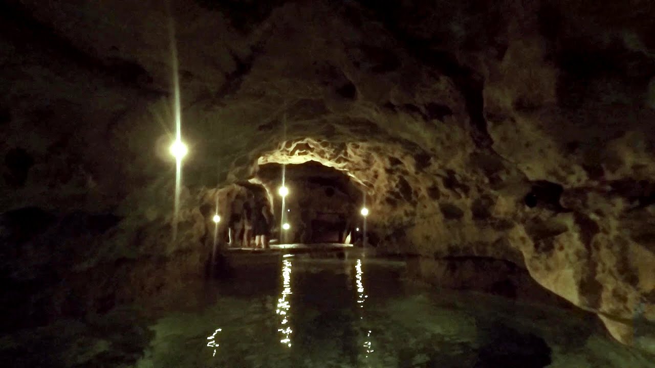
Manita pec cave - Croatia - photos


Page no. 1, photos: 1-6, 21 photos in total. >>>

There are 115 caves so far known in the Paklenica National Park, Manita pec is the most famous one, and is open to the public for guided visits. The cave has beautiful chambers, and various cave formations such as stalagmites, stalactites, columns, and flowstones. Read more
Copyright © 2010 - 2025 Trekkingklub.com.
Already published 8162 photos and 136 videos. Please register for full access.
Photos of nearby places

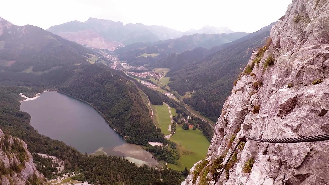
Paklenica National Park - Croatia (55 photos) 2.63 km away
In 1949, the area of Velika and Mala Paklenica was designated as a national park due to its natural features, forests, and geomorphologic structures. The main purpose was to protect the largest and best-preserved forest complex in Dalmatia, which was at risk from excessive exploitation.

Port of Jablanac - Croatia (18 photos) 63.24 km away
Situated in Lika-Senj county, Croatia, Jablanac is a village located beneath the Velebit mountain, overlooking the neighboring island of Rab in the Adriatic Sea. In close proximity to Jablanac are the Velebit mountain and the Northern Velebit National Park.

Plitvice Lakes - Croatia (60 photos) 66.04 km away
The Plitvice Lakes National Park is the oldest and largest national park in Croatia. It is located in a mountainous region between Mala Kapela and Licka Pljesivica.

Rab Island - Croatia (24 photos) 74.83 km away
Rab is a small island located in the Adriatic Sea, belonging to Croatia. It is known for its beautiful beaches, mild climate, and historic town of the same name.

Slunjcica - Rastoke, Slunj - Croatia (12 photos) 90.01 km away
The Slunjcica river is situated in central Croatia, flowing through the Kordun region. The city of Slunj is named after this river.

Old town Krk - Krk Island, Croatia (11 photos) 106.39 km away
Krk is a Croatian island located in the Adriatic Sea. It is the largest island in the country, and has a rich history dating back to ancient times.

Skocjan Caves - Slovenia (22 photos) 190.29 km away
The Skocjan Caves (Skocjanske jame) are a system of underground caves located in the Karst region of Slovenia. These caves are famous for their breathtaking natural beauty, and extensive underground river system.
[ Top ↑ ]
Videos of nearby places
Tapolca lake cave - Balaton-felvidéki National Park 324.08 km away
The Tapolca lake cave is situated in the Balaton-felvidéki National Park. A modern visitor center has been constructed at its entrance, featuring ten rooms that highlight the unique characteristics of karst regions.
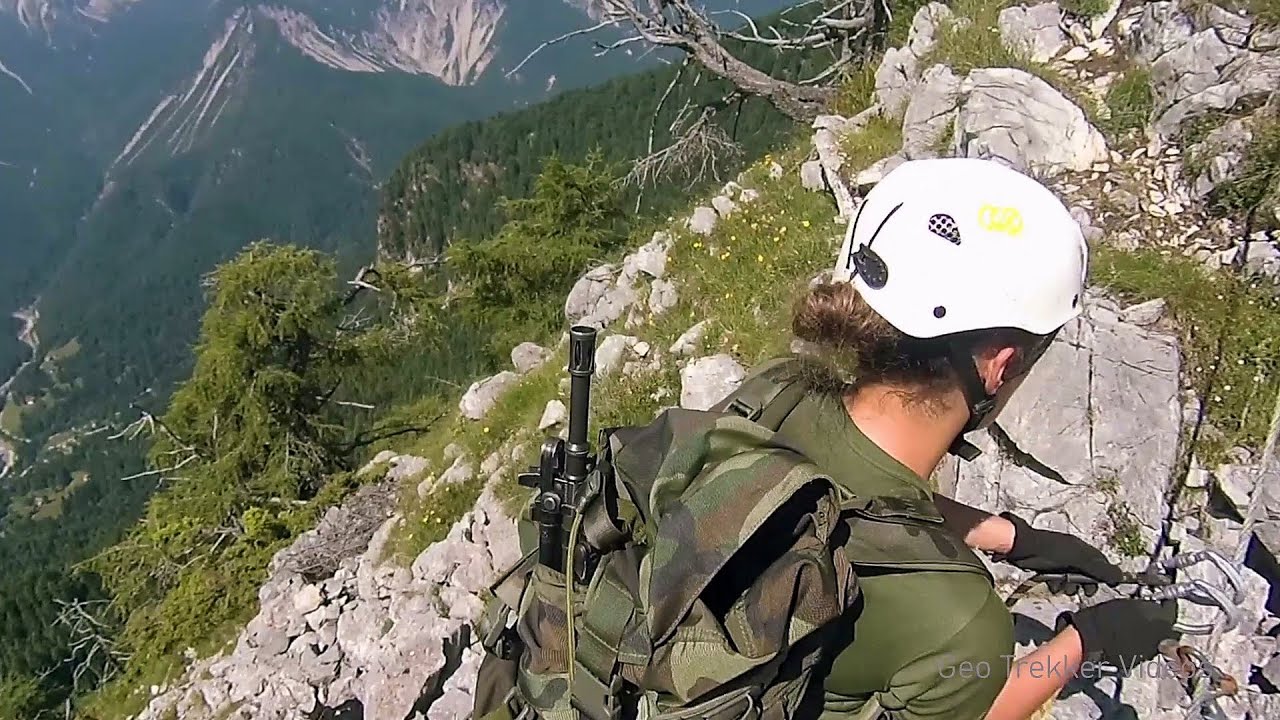
Via ferrata Adventure Climb Varmost - Forni di Sopra, Cima Clap Varmost, Alpi Carniche 327.96 km away
I participated in a joint, Szekler-Italian 'military exercise' :-) on the Adventure Climb Varmost via ferrata. The iron climbing route is located in the Friuli-Venezia Giulia region, in the Carnic Alps, and it leads up to the summit of Clap Varmost above Forni di Sopra.
Kaiserschild Klettersteig - Eisenerzer Ramsau 361.11 km away
The 2,085-meter-high Kaiserschild peak is situated on the northern edge of the Eisenerz Alps in Styria, Austria. It forms a double summit with the slightly taller Hochkogel peak, which stands at 2,105 meters.
Leopoldsteiner lake - Eisenerz, Steiermark 365.51 km away
Leopoldsteiner See is located in Styria, 4 km northwest of the town of Eisenerz. It lies at an elevation of 628 meters above sea level in the western part of the Hochschwab mountain range, at the foot of the Seemauer cliff.
Kaiser Franz-Josef Klettersteig - Leopoldsteiner See 365.75 km away
The Franz-Josef Klettersteig is located on the Seemauer cliff face, which rises 900 meters above Leopoldsteiner Lake, in the western part of the Hochschwab mountain range, just 4 km from the town of Eisenerz. This via ferrata is named after the Kaisersteig, a hunting trail established for the esteemed Emperor Franz Joseph I of Austria and Hungary at the end of the 19th century, traces of which can still be observed today.
Other places
Crystal Cave at Farcu Mine 607.98 km away
In the Padurea Craiului Mountains, near Rosia, in the Farcu bauxite mine, in 1987, the miners accidentally discovered a cave. It was filled with crystal-shaped limestone formations.
In the Padurea Craiului Mountains, near Rosia, in the Farcu bauxite mine, in 1987, the miners accidentally discovered a cave. It was filled with crystal-shaped limestone formations.
Shipka pass Shipka 812.06 km away
The Shipka Pass is one of the most spectacular crossings of the Balkan Mountains, and is part of the Bulgarka Nature Park. It separates the provinces of Gabrovo and Stara Zagora, and provides a connection between the cities of Gabrovo and Kazanlak.
The Shipka Pass is one of the most spectacular crossings of the Balkan Mountains, and is part of the Bulgarka Nature Park. It separates the provinces of Gabrovo and Stara Zagora, and provides a connection between the cities of Gabrovo and Kazanlak.
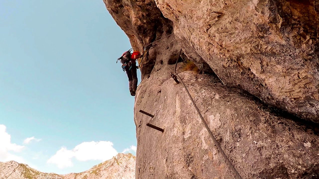
The Devil's Iron Path Aussois, Savoy, Rhône Alps 696.54 km away
The Devil's Iron Path (Via ferrata du Diable) is a multi-part via ferrata, located above a spectacular waterfall (Cascade du Nant), in a gorge, below the Victor-Emmanuel fort. For me, this climbing route presented the greatest challenge so far (2015).
The Devil's Iron Path (Via ferrata du Diable) is a multi-part via ferrata, located above a spectacular waterfall (Cascade du Nant), in a gorge, below the Victor-Emmanuel fort. For me, this climbing route presented the greatest challenge so far (2015).
Giant Ice Cave (Rieseneishöhle) Dachstein Salzkammergut, Obertraun am Hallstättersee 383 km away
The second cave accessible to the public at the Schönbergalm above Obertraun on Lake Hallstatt is the Giant Ice Cave (Rieseneishöhle). For me, it was more spectacular than the Mammoth Cave.
The second cave accessible to the public at the Schönbergalm above Obertraun on Lake Hallstatt is the Giant Ice Cave (Rieseneishöhle). For me, it was more spectacular than the Mammoth Cave.
God's bridge (Bozhite mostove, Bozhi Most) Vratsa 657.18 km away
Anyone who has been to Bulgaria may be familiar with the Prohodna Cave, affectionately known as the Eyes of God; the Devetashka Cave, illuminated by seven windows in its ceiling; and perhaps they have also seen the Wonderful Bridges in the Rhodope Mountains. But there is another spectacular natural stone bridge in this country, known as the Bridge of God.
Anyone who has been to Bulgaria may be familiar with the Prohodna Cave, affectionately known as the Eyes of God; the Devetashka Cave, illuminated by seven windows in its ceiling; and perhaps they have also seen the Wonderful Bridges in the Rhodope Mountains. But there is another spectacular natural stone bridge in this country, known as the Bridge of God.
[ Top ↑ ]
[ Top ↑ ]
Copyright © 2003-2025 Trekkingklub and friends. Reproduction of any text, picture or video from this website, either in printed or electronic form, is prohibited without prior written permission. The given distances are to be understood as straight line distances, and are approximate. Website made in Miercurea Ciuc  .
.