Rab Island - Croatia - photos


Page no. 1, photos: 1-6, 24 photos in total. >>>

Rab is a small island located in the Adriatic Sea, belonging to Croatia. It is known for its beautiful beaches, mild climate, and historic town of the same name. The island has a rich history, that dates back to prehistoric times, and has been influenced by various cultures over the centuries. Read more
Copyright © 2010 - 2025 Trekkingklub.com.
Already published 8162 photos and 136 videos. Please register for full access.
Photos of nearby places

Port of Jablanac - Croatia (18 photos) 12.02 km away
Situated in Lika-Senj county, Croatia, Jablanac is a village located beneath the Velebit mountain, overlooking the neighboring island of Rab in the Adriatic Sea. In close proximity to Jablanac are the Velebit mountain and the Northern Velebit National Park.

Old town Krk - Krk Island, Croatia (11 photos) 33.52 km away
Krk is a Croatian island located in the Adriatic Sea. It is the largest island in the country, and has a rich history dating back to ancient times.

Plitvice Lakes - Croatia (60 photos) 68.93 km away
The Plitvice Lakes National Park is the oldest and largest national park in Croatia. It is located in a mountainous region between Mala Kapela and Licka Pljesivica.

Manita pec cave - Croatia (21 photos) 74.83 km away
There are 115 caves so far known in the Paklenica National Park, Manita pec is the most famous one, and is open to the public for guided visits. The cave has beautiful chambers, and various cave formations such as stalagmites, stalactites, columns, and flowstones.

Paklenica National Park - Croatia (55 photos) 75.28 km away
In 1949, the area of Velika and Mala Paklenica was designated as a national park due to its natural features, forests, and geomorphologic structures. The main purpose was to protect the largest and best-preserved forest complex in Dalmatia, which was at risk from excessive exploitation.

Slunjcica - Rastoke, Slunj - Croatia (12 photos) 76.62 km away
The Slunjcica river is situated in central Croatia, flowing through the Kordun region. The city of Slunj is named after this river.

Skocjan Caves - Slovenia (22 photos) 117.92 km away
The Skocjan Caves (Skocjanske jame) are a system of underground caves located in the Karst region of Slovenia. These caves are famous for their breathtaking natural beauty, and extensive underground river system.
[ Top ↑ ]
Videos of nearby places
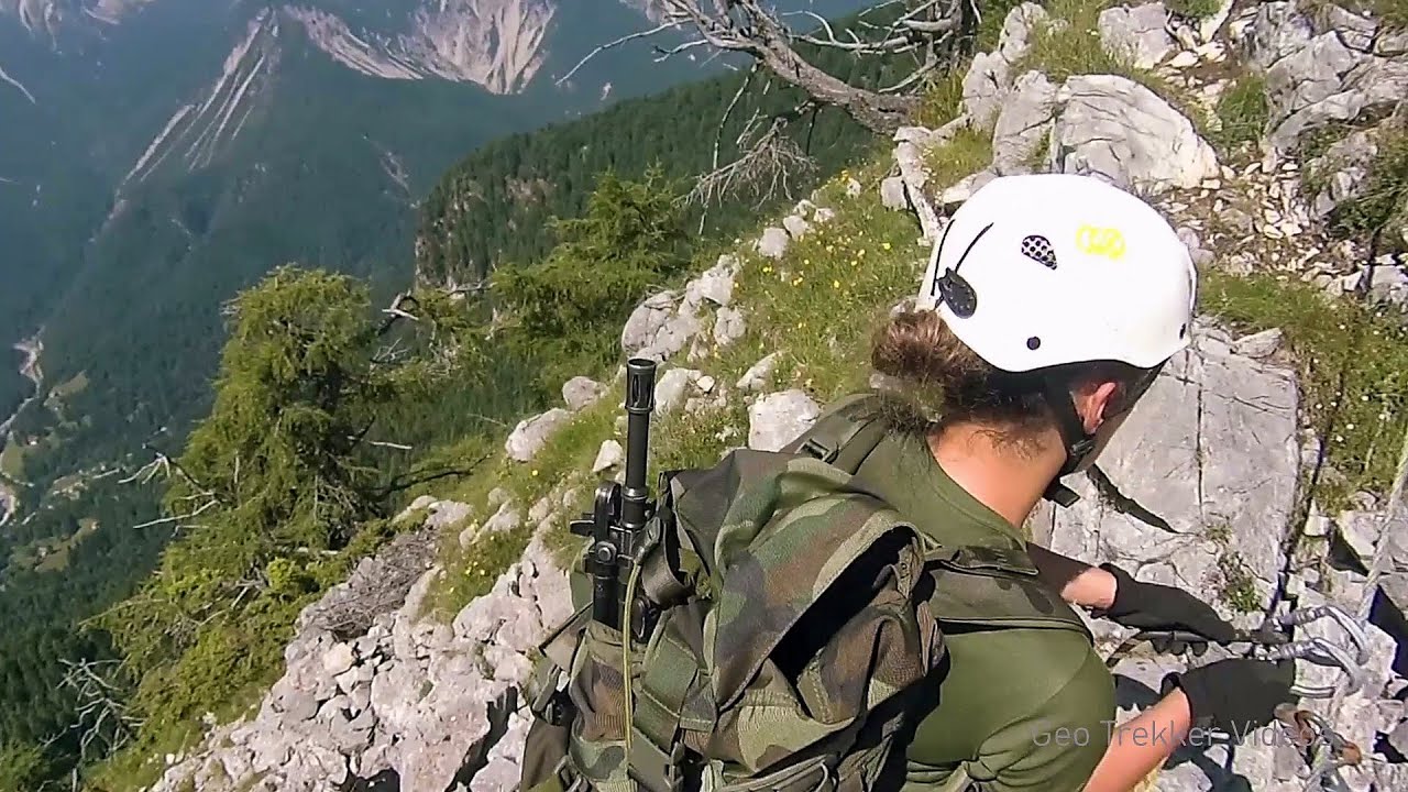
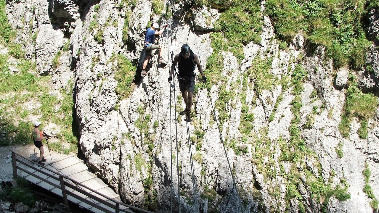
Via ferrata Adventure Climb Varmost - Forni di Sopra, Cima Clap Varmost, Alpi Carniche 253.67 km away
I participated in a joint, Szekler-Italian 'military exercise' :-) on the Adventure Climb Varmost via ferrata. The iron climbing route is located in the Friuli-Venezia Giulia region, in the Carnic Alps, and it leads up to the summit of Clap Varmost above Forni di Sopra.
Kaiserschild Klettersteig - Eisenerzer Ramsau 308.66 km away
The 2,085-meter-high Kaiserschild peak is situated on the northern edge of the Eisenerz Alps in Styria, Austria. It forms a double summit with the slightly taller Hochkogel peak, which stands at 2,105 meters.
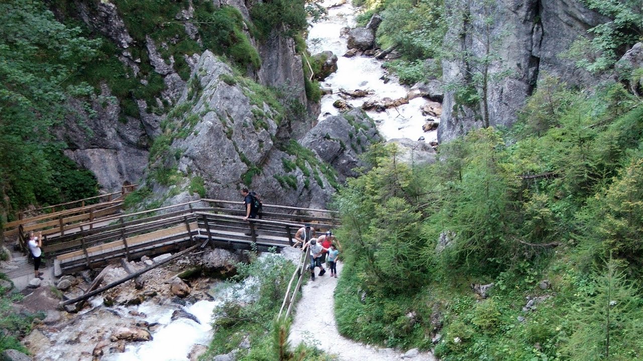
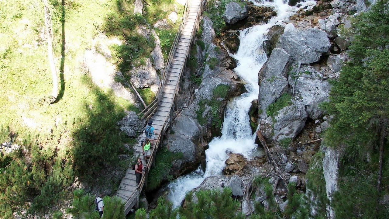
Silberkar Gorge (Silberkarklamm) - Ramsau am Dachstein, Austria 308.88 km away
One of the most beautiful hiking spots in the area of Ramsau am Dachstein, is the Silberkarklamm. It is possible to drive to the entrance of the gorge, there is parking available on the side of the road, and you have to pay an entrance fee.
Hias via ferrata - Silberkarklamm, Ramsau am Dachstein 309.06 km away
The Hias via ferrata in the Silberkar Gorge (Silberkarklamm) is the first of the three via ferrata routes, and perhaps the easiest to complete. Two cable bridges and a few trickier sections make it interesting, but it is truly impressive due to the view of the narrow gorge.
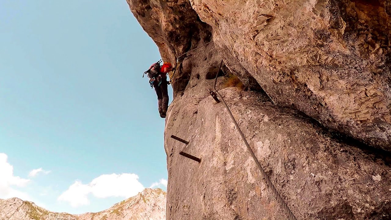
Rosina via ferrata - Silberkar Gorge, Ramsau am Dachstein 309.16 km away
The Rosina via ferrata is the most difficult via ferrata in the Silberkar Gorge (Silberkarklamm), has a D difficulty rating, and it is a vertical masterpiece. After a short suspension bridge above the stream, it leads up the rock wall next to the gorge waterfall, all the way vertically.
Other places
Seven Ladder Canyon in Winter Piatra Mare Mountain 857.25 km away
Seven Ladder Canyon and Waterfall in Winter - Piatra Mare Mountain
Seven Ladder Canyon and Waterfall in Winter - Piatra Mare Mountain
The Trovants Museum in Winter Costesti 733.32 km away
The Stone Wedding Zimzelen, Kardzhali 927.54 km away
The Stone Wedding (Kamenna Svatba, Petrified Wedding, Kardzhali Pyramids) is located near the village of Zimzelen, close to the city of Kardzhali, in the eastern part of the Rhodope Mountains in Bulgaria. This spectacular natural formation was declared a natural monument in 1974.
The Stone Wedding (Kamenna Svatba, Petrified Wedding, Kardzhali Pyramids) is located near the village of Zimzelen, close to the city of Kardzhali, in the eastern part of the Rhodope Mountains in Bulgaria. This spectacular natural formation was declared a natural monument in 1974.
Billy-goat lake, Closed Gates Retezat Mountains 644.45 km away
The most unique ridge trail of the Retezat Mountains is the Closed Gates.Below, at an altitude of 2070 m above sea level, is the Billy-goat lake.
The most unique ridge trail of the Retezat Mountains is the Closed Gates.Below, at an altitude of 2070 m above sea level, is the Billy-goat lake.
Poienii Rock, north-eastern lookout point Bicaz Gorges 886.95 km away
From the viewpoint at the top of the northeastern wall of Poienii Rock in the Bicaz Gorges, we can look down 300 meters to the mouth of the Bicajel stream. The Bridge of the Hungarians is hidden among pine trees.
From the viewpoint at the top of the northeastern wall of Poienii Rock in the Bicaz Gorges, we can look down 300 meters to the mouth of the Bicajel stream. The Bridge of the Hungarians is hidden among pine trees.
[ Top ↑ ]
[ Top ↑ ]
Copyright © 2003-2025 Trekkingklub and friends. Reproduction of any text, picture or video from this website, either in printed or electronic form, is prohibited without prior written permission. The given distances are to be understood as straight line distances, and are approximate. Website made in Miercurea Ciuc  .
.