Venice - Italy | Photos


Page no. 1, photos: 1-10, 60 photos in total. >>>

Venice (Venezia) is a city located in northeastern Italy, it is the capital of the region of Veneto. It is known for its unique setup of being built on a lagoon, on a group of islands separated by canals and connected by bridges. Read more
Copyright © 2010 - 2025 Trekkingklub.com.
Already published 8983 photos and 180 videos. Please register for full and ad-free access.
Photos of nearby places

Skocjan Caves - Slovenia (22 photos) 131.17 km away
The Skocjan Caves (Skocjanske jame) are a system of underground caves located in the Karst region of Slovenia. These caves are famous for their breathtaking natural beauty, and extensive underground river system.

Napoleon Bridge - Kobarid, Slovenia (22 photos) 132.45 km away
The Napoleon bridge (Napoleonov most) is located near Kobarid, on the banks of the Soca (Isonzo) river. The bridge has existed since ancient times, and has undergone multiple demolitions and reconstructions.

Boka Waterfall - Slovenia (11 photos) 132.48 km away
Boka (Slap Boka) is a waterfall in western Slovenia, near the Soca River. It has two stages, with the first being 106 m high and 18 m wide, and the second being 33 m high.

Slap Kozjak waterfall - Slovenia (24 photos) 133.63 km away
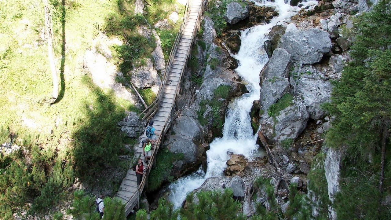
Slap Kozjak waterfall, perhaps the most beautiful waterfall in Slovenia, is situated near Kobarid. Located within the Kozjak stream gorge, and overlooking the stunning emerald green Soca River, this magnificent waterfall cascades 15 meters high, and is enclosed within a mesmerizing stone chamber.

Kanin cableway and ski resort - Shooting window, Monte Forato, Bovec, Sella Nevea (48 photos) 135.28 km away
The Kanin Mountains are located in the Western Julian Alps, on the border of Slovenia and Italy. The highest peak in this range, known as (High) Kanin or Monte Canin Alto, in Slovenian and Italian respectively, reaches a height of 2,587 m above sea level.

Predjama Castle - Slovenia (54 photos) 145.41 km away
Predjama Castle built onto a cave, is situated on a cliff, in the village of Predjama, Slovenia. The castle has a rich history dating back to the 13th century.

Slap Savica waterfall - Slovenia (12 photos) 147.88 km away
Slap Savica, found in the northwestern part of Slovenia, is a magnificent, 78 m high waterfall. It derives its water from a karst spring called Savica located just above the falls.

Vogel Ski Resort - Slovenia (33 photos) 148.49 km away
Vogel Ski Resort is situated in Slovenia, above Bohinj and adjacent to Lake Bohinj, on the outskirts of Triglav National Park. The resort derives its name from the nearby Mount Vogel, and was established in 1964.
[ Top ↑ ]
Videos of nearby places
Via ferrata Adventure Climb Varmost - Forni di Sopra, Cima Clap Varmost, Alpi Carniche 113.4 km away
I participated in a joint, Szekler-Italian 'military exercise' :-) on the Adventure Climb Varmost via ferrata. The iron climbing route is located in the Friuli-Venezia Giulia region, in the Carnic Alps, and it leads up to the summit of Clap Varmost above Forni di Sopra.
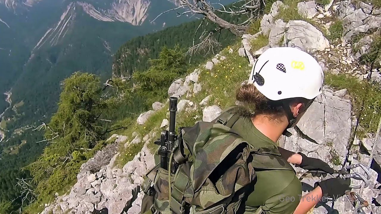
Via ferrata Rio Sallagoni - Drena, Italia 124.25 km away
The surrounding iron climbing routes are located on rock walls exposed to a scorching sun. But the Rio Sallagoni via ferrata goes upwards in a pleasantly cool gorge, above the creek and waterfalls, and eventually reaches the Drena Castle.
Via ferrata Ernesto Che Guevara al Monte Casale, Monti del Garda, Trentino Alto Adige 126.78 km away
The Che Guevara via ferrata is the longest iron climbing route I have ever climbed. There is a 1400 m level difference from the starting point to the peak of Monte Casale.
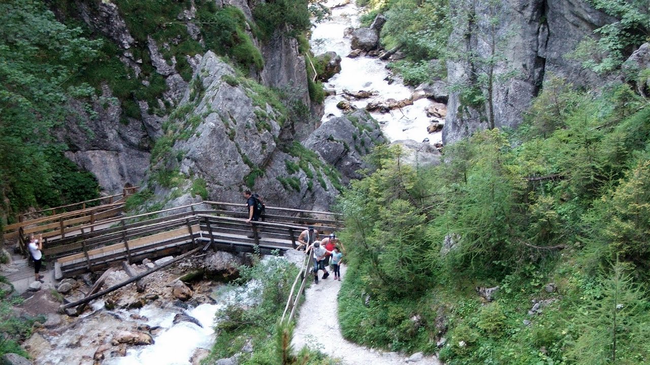
Silberkar Gorge (Silberkarklamm) - Ramsau am Dachstein, Austria 246.41 km away
One of the most beautiful hiking spots in the area of Ramsau am Dachstein, is the Silberkarklamm. It is possible to drive to the entrance of the gorge, there is parking available on the side of the road, and you have to pay an entrance fee.
Hias via ferrata - Silberkarklamm, Ramsau am Dachstein 246.56 km away
The Hias via ferrata in the Silberkar Gorge (Silberkarklamm) is the first of the three via ferrata routes, and perhaps the easiest to complete. Two cable bridges and a few trickier sections make it interesting, but it is truly impressive due to the view of the narrow gorge.
Other places
Play Wall via ferrata park Mariazeller via ferrata, Felix's Ladder to the Heaven, Devil's Bridge 338.67 km away
Located only ten kilometers from the town of Mariazell, you'll find the via ferrata park known as the Play Wall (Klettersteigpark Spielmäuer). Here, we find three via ferratas: Olivers Mariazeller Steig (B/C), Felix Himmelleiter (D), and Tristans Kirchbogensteig (C).
Located only ten kilometers from the town of Mariazell, you'll find the via ferrata park known as the Play Wall (Klettersteigpark Spielmäuer). Here, we find three via ferratas: Olivers Mariazeller Steig (B/C), Felix Himmelleiter (D), and Tristans Kirchbogensteig (C).
Giant Ice Cave (Rieseneishöhle) Dachstein Salzkammergut, Obertraun am Hallstättersee 256.39 km away
The second cave accessible to the public at the Schönbergalm above Obertraun on Lake Hallstatt is the Giant Ice Cave (Rieseneishöhle). For me, it was more spectacular than the Mammoth Cave.
The second cave accessible to the public at the Schönbergalm above Obertraun on Lake Hallstatt is the Giant Ice Cave (Rieseneishöhle). For me, it was more spectacular than the Mammoth Cave.
Trift valley, bridge, lake and glacier Gadmen, Switzerland 337.51 km away
During the hike in Trift Valley, I experienced cloudy and gloomy weather with intermittent rain. Here is the 170 m long Trift Bridge, the longest pedestrian suspension bridge in the Swiss Alps, in a breathtaking environment, 100 meters above the Trift Glacier Lake.
During the hike in Trift Valley, I experienced cloudy and gloomy weather with intermittent rain. Here is the 170 m long Trift Bridge, the longest pedestrian suspension bridge in the Swiss Alps, in a breathtaking environment, 100 meters above the Trift Glacier Lake.
Rosina via ferrata Silberkar Gorge, Ramsau am Dachstein 246.62 km away
The Rosina via ferrata is the most difficult via ferrata in the Silberkar Gorge (Silberkarklamm), has a D difficulty rating, and it is a vertical masterpiece. After a short suspension bridge above the stream, it leads up the rock wall next to the gorge waterfall, all the way vertically.
The Rosina via ferrata is the most difficult via ferrata in the Silberkar Gorge (Silberkarklamm), has a D difficulty rating, and it is a vertical masterpiece. After a short suspension bridge above the stream, it leads up the rock wall next to the gorge waterfall, all the way vertically.
Kaiserschild Klettersteig Eisenerzer Ramsau 300.94 km away
The 2,085-meter-high Kaiserschild peak is situated on the northern edge of the Eisenerz Alps in Styria, Austria. It forms a double summit with the slightly taller Hochkogel peak, which stands at 2,105 meters.
The 2,085-meter-high Kaiserschild peak is situated on the northern edge of the Eisenerz Alps in Styria, Austria. It forms a double summit with the slightly taller Hochkogel peak, which stands at 2,105 meters.
[ Top ↑ ]
[ Top ↑ ]
Select language: - Magyar - Romana - Deutsch - Français - Italiano - Español - Copyright © 2003-2025 Trekkingklub and friends. Reproduction of any text, picture or video from this website, either in printed or electronic form, is prohibited without prior written permission. The given distances are to be understood as straight line distances, and are approximate. Website made in Miercurea Ciuc