Rome - Italy - photos


Page no. 1, photos: 1-6, 24 photos in total. >>>

Rome is the capital city of Italy. With a history spanning over 2,800 years, it is one of the oldest continuously occupied cities in the world. It was the center of the Roman Empire, which was one of the largest and most powerful empires in history. Read more
Copyright © 2023 Kincső, - 2025 Trekkingklub.com.
Already published 8162 photos and 136 videos. Please register for full access.
Photos of nearby places

Paklenica National Park - Croatia (55 photos) 359.68 km away
In 1949, the area of Velika and Mala Paklenica was designated as a national park due to its natural features, forests, and geomorphologic structures. The main purpose was to protect the largest and best-preserved forest complex in Dalmatia, which was at risk from excessive exploitation.

Manita pec cave - Croatia (21 photos) 362.27 km away
There are 115 caves so far known in the Paklenica National Park, Manita pec is the most famous one, and is open to the public for guided visits. The cave has beautiful chambers, and various cave formations such as stalagmites, stalactites, columns, and flowstones.

Rab Island - Croatia (24 photos) 367.55 km away
Rab is a small island located in the Adriatic Sea, belonging to Croatia. It is known for its beautiful beaches, mild climate, and historic town of the same name.

Port of Jablanac - Croatia (18 photos) 368.59 km away
Situated in Lika-Senj county, Croatia, Jablanac is a village located beneath the Velebit mountain, overlooking the neighboring island of Rab in the Adriatic Sea. In close proximity to Jablanac are the Velebit mountain and the Northern Velebit National Park.

Old town Krk - Krk Island, Croatia (11 photos) 387.09 km away
Krk is a Croatian island located in the Adriatic Sea. It is the largest island in the country, and has a rich history dating back to ancient times.

Venice - Italy (60 photos) 394.22 km away
Venice (Venezia) is a city located in northeastern Italy, it is the capital of the region of Veneto. It is known for its unique setup of being built on a lagoon, on a group of islands separated by canals and connected by bridges.

Plitvice Lakes - Croatia (60 photos) 418.85 km away
The Plitvice Lakes National Park is the oldest and largest national park in Croatia. It is located in a mountainous region between Mala Kapela and Licka Pljesivica.
[ Top ↑ ]
Videos of nearby places
L'Escale á Peille iron path - Maritime Alps, France 466.01 km away
One of the challenging via ferratas in the Maritime Alps is the l'Escale a Peille. One of its elements is a steel cobweb, where you can feel like you're hanging in the air.
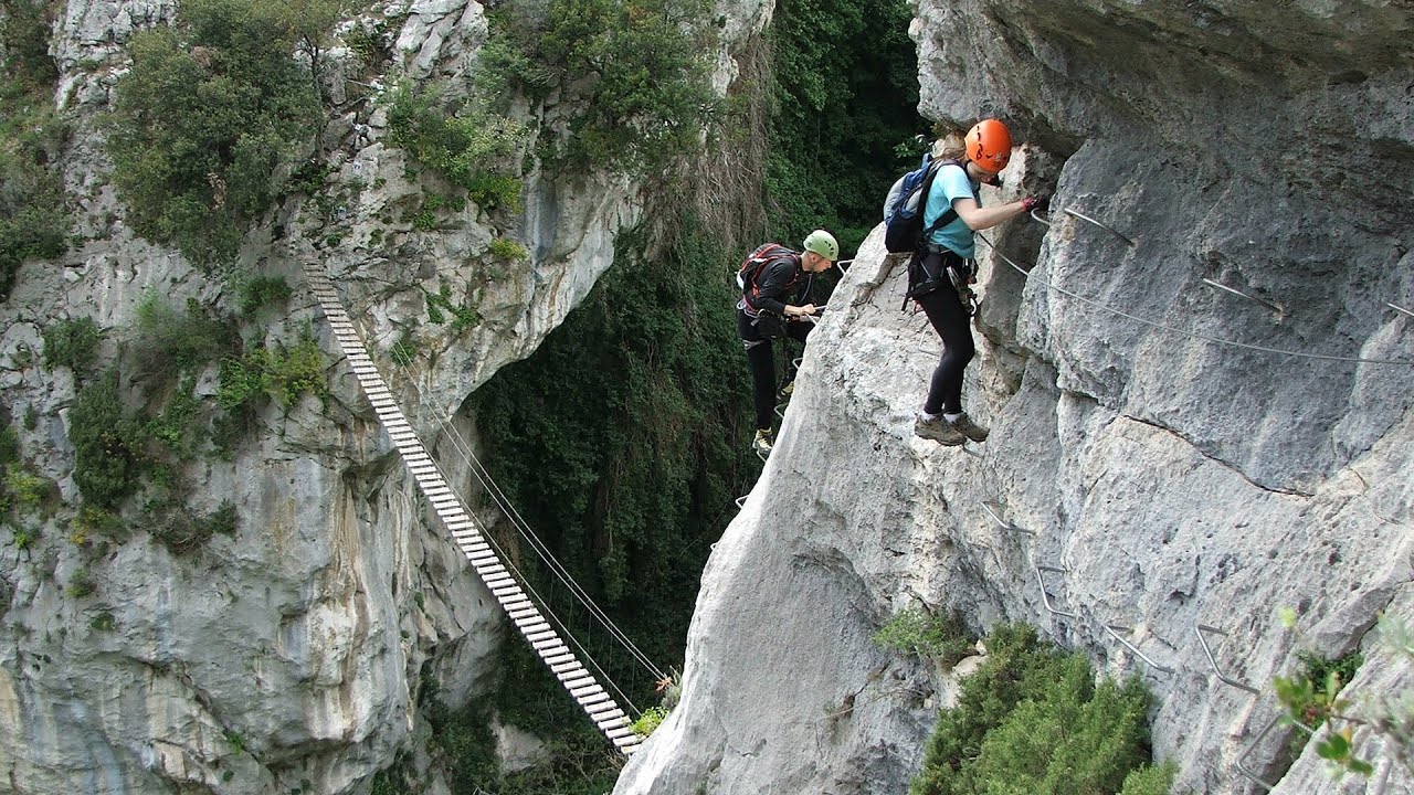
Via ferrata Rio Sallagoni - Drena, Italia 470.45 km away
The surrounding iron climbing routes are located on rock walls exposed to a scorching sun. But the Rio Sallagoni via ferrata goes upwards in a pleasantly cool gorge, above the creek and waterfalls, and eventually reaches the Drena Castle.
Via ferrata Ernesto Che Guevara al Monte Casale, Monti del Garda, Trentino Alto Adige 476.3 km away
The Che Guevara via ferrata is the longest iron climbing route I have ever climbed. There is a 1400 m level difference from the starting point to the peak of Monte Casale.
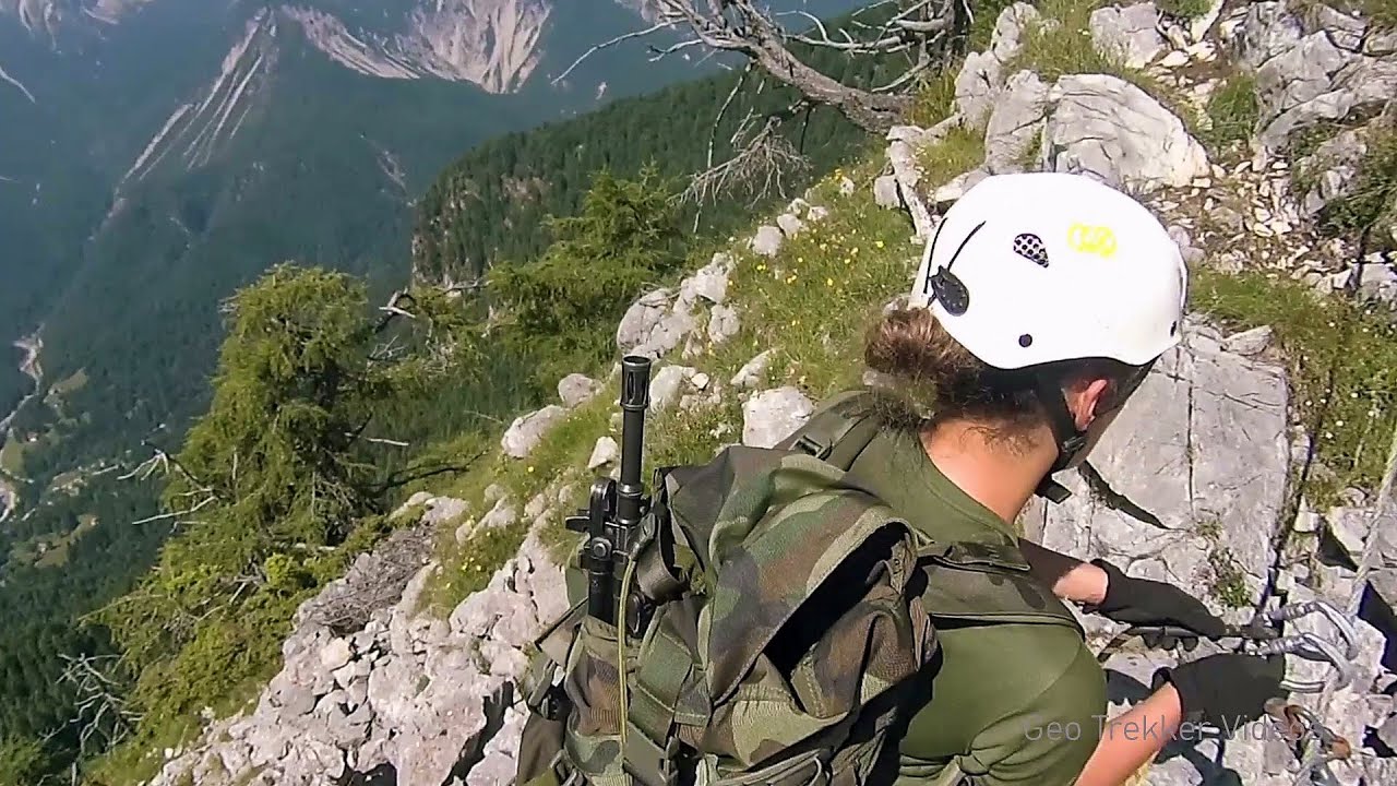
Via ferrata Adventure Climb Varmost - Forni di Sopra, Cima Clap Varmost, Alpi Carniche 506.08 km away
I participated in a joint, Szekler-Italian 'military exercise' :-) on the Adventure Climb Varmost via ferrata. The iron climbing route is located in the Friuli-Venezia Giulia region, in the Carnic Alps, and it leads up to the summit of Clap Varmost above Forni di Sopra.
Via Ferrata Centenario C.A.O - Monte Grona, Prealpi Lombarde, Lombardia 532.85 km away
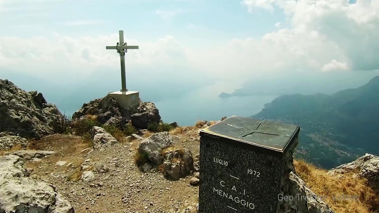
In the magnificent rocky world of Monte Grona, the Centenario via ferrata leads upwards, which I had the opportunity to climb accompanied by lizards. Although it was cloudy and gloomy, I had a great view of Lake Lugano and Lake Como along the way.
Other places
Stan Valley Canyon 1048.03 km away
The Stan Valley is located near Lake Vidraru, southwest of it, in the Fruntii Mountains. Those who have visited the Seven Ladders Waterfall will appreciate this canyon, outfitted with infrastructure for tourist accessibility.
The Stan Valley is located near Lake Vidraru, southwest of it, in the Fruntii Mountains. Those who have visited the Seven Ladders Waterfall will appreciate this canyon, outfitted with infrastructure for tourist accessibility.
Jumping waterfall (Cascada Saritoarea, Szökő) Harghita Mountains 1159.86 km away
Vulva cave Rhodope Mountains 1056.58 km away
The Vulva Cave (Peshtera Utroba) is situated near the village of Nenkovo and the city of Kardzhali, in the Rhodope Mountains of Bulgaria. It derives its name from the shape of its entrance, which resembles a vulva.
The Vulva Cave (Peshtera Utroba) is situated near the village of Nenkovo and the city of Kardzhali, in the Rhodope Mountains of Bulgaria. It derives its name from the shape of its entrance, which resembles a vulva.
Iron path Harghita-Madaras 1157.59 km away
Amateur filming in Harghita-Madaras, holding the camera by hand in the car, and helmet-mounted on the via ferrata. I climbed an iron path for the first time in my life on the Nyerges cliffs (Stancile Seii), I didn't have the right equipment yet.
Amateur filming in Harghita-Madaras, holding the camera by hand in the car, and helmet-mounted on the via ferrata. I climbed an iron path for the first time in my life on the Nyerges cliffs (Stancile Seii), I didn't have the right equipment yet.
Orlovo Oko (Eagle's Eye) Yagodina 982.07 km away
Orlovo Oko (Eagle's Eye) is a lookout viewpoint located in the Rhodope Mountains, near the peak of Saint Ilia and close to the village of Yagodina, Bulgaria. The steel structure, built at an altitude of 1,563 meters, rises 670 meters above the spectacular Buynovsko Gorge, along with the winding river and road that traverse it.
Orlovo Oko (Eagle's Eye) is a lookout viewpoint located in the Rhodope Mountains, near the peak of Saint Ilia and close to the village of Yagodina, Bulgaria. The steel structure, built at an altitude of 1,563 meters, rises 670 meters above the spectacular Buynovsko Gorge, along with the winding river and road that traverse it.
[ Top ↑ ]
[ Top ↑ ]
Copyright © 2003-2025 Trekkingklub and friends. Reproduction of any text, picture or video from this website, either in printed or electronic form, is prohibited without prior written permission. The given distances are to be understood as straight line distances, and are approximate. Website made in Miercurea Ciuc  .
.