Crater of the extinct volcano of Racos - Persani Mountains - photos


Page no. 1, photos: 1-6, 30 photos in total. >>>

Copyright © 2009 - 2025 Trekkingklub.com.
Already published 8178 photos and 136 videos. Please register for full access.
Photos of nearby places


Thieves' Cave - Persani Mountains (20 photos) 6.1 km away
The Thieves' Cave at Apata is located in the valley of the Tepeu creek, renowned for its outcrop of red clayey limestone, which is very rich in ammonites. A tributary of the stream is formed by the waters of a spring fed by the watercourse coming from the cave's gallery.


[ Top ↑ ]
Videos of nearby places
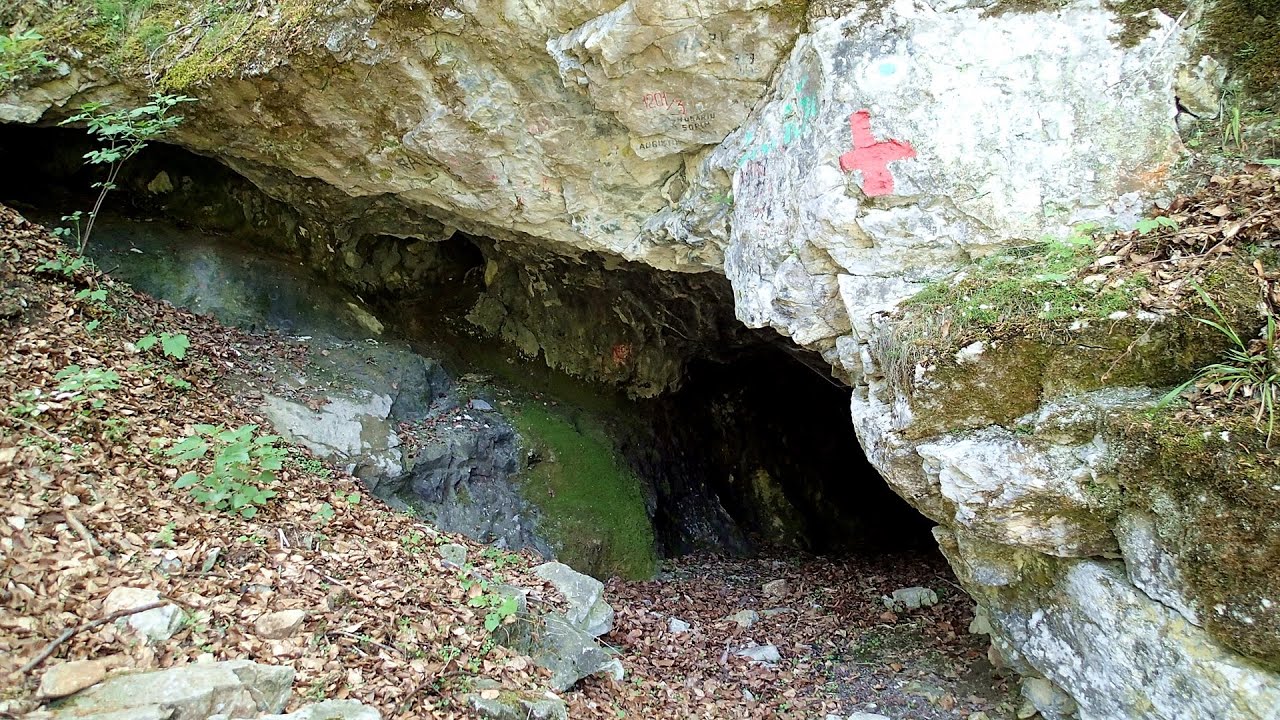
The Cave of Thieves (Pestera Hotilor, Tolvajos) - Apata 6.1 km away
The Cave of Thieves, located in the Olt Gorge at Racos, is situated at the source of the Tepeu creek. From the karst spring that emerges from the cave, one of the branches of the creek originates.

Varghis gorges in winter 22.91 km away
I went out to admire the ice stalagmites (standing icicles) in the Varghis Gorge. Anyone arriving here at the end of winter can observe meter-high ice stalagmites in the entrance area of Meresti Cave (now known as Orban Balazs Cave).

Preacher's Rock - Bodoc Mountains 36.71 km away
In the Bodoc Mountains, west-southwest from the Henter peak, we find a rock formation shaped like a mushroom by erosion, called Preacher's Rock. This 2-meter high rock probably got its name from the pagan Hungarian priests, who preached here in the past.

Saint Anne lake - Ciomat-Puturosu 37.66 km away
Lake Saint Anna is the only well-preserved volcanic crater lake in Eastern Europe. Here are some images from an afternoon outing.

The Heart of Jesus look-out - Lupeni 42.12 km away
Through the mud on Gordon Mountain, above Farkaslaka (Lupeni commune, Harghita county, Transilvania), on a cloudy afternoon, at the end of February. The destination is the Heart of Jesus lookout, nicknamed as Pléhkrisztus (The Tin Christ).
Other places
Kaiserschild Klettersteig Eisenerzer Ramsau 822.92 km away
The 2,085-meter-high Kaiserschild peak is situated on the northern edge of the Eisenerz Alps in Styria, Austria. It forms a double summit with the slightly taller Hochkogel peak, which stands at 2,105 meters.
The 2,085-meter-high Kaiserschild peak is situated on the northern edge of the Eisenerz Alps in Styria, Austria. It forms a double summit with the slightly taller Hochkogel peak, which stands at 2,105 meters.
Doabra Stones Brezoi, Lotru Mountains 118.19 km away
The DN7A road branches off west from the Olt Valley, from the main road between Sibiu and Ramnicu Valcea, leading towards Voineasa and Lake Vidra. The first settlement is a small town, Brezoi, which is located at the confluence of the Lotru and Olt rivers.
The DN7A road branches off west from the Olt Valley, from the main road between Sibiu and Ramnicu Valcea, leading towards Voineasa and Lake Vidra. The first settlement is a small town, Brezoi, which is located at the confluence of the Lotru and Olt rivers.
Hot Air Balloon Parade 2018 Campu Cetatii 77.59 km away
This year, the hot air balloons flew low over Campu Cetatii. The weather did not really favor the parade.
This year, the hot air balloons flew low over Campu Cetatii. The weather did not really favor the parade.
The Amphitheater of the Dragons (Amfiteatrul Zmeilor) Baia de Fier 159.67 km away
The Amphitheater of the Dragons is the seventh (2017) via ferrata route in Baia de Fier. It was inaugurated last year, on December 26, 2017, after Christmas.
The Amphitheater of the Dragons is the seventh (2017) via ferrata route in Baia de Fier. It was inaugurated last year, on December 26, 2017, after Christmas.
Rhein Gorge Flims, Switzerland 1234.81 km away
The Rhine River (in German, Rhein) originates in the Swiss canton of Graubünden at the Oberalppass and flows into the North Sea at Rotterdam in the Netherlands after traveling 1,324 km. The Rhine Gorge, also known as the Swiss Grand Canyon (in Romansh, Ruinaulta), winds for 14 km between 350 m high white walls.
The Rhine River (in German, Rhein) originates in the Swiss canton of Graubünden at the Oberalppass and flows into the North Sea at Rotterdam in the Netherlands after traveling 1,324 km. The Rhine Gorge, also known as the Swiss Grand Canyon (in Romansh, Ruinaulta), winds for 14 km between 350 m high white walls.
[ Top ↑ ]
[ Top ↑ ]
Copyright © 2003-2025 Trekkingklub and friends. Reproduction of any text, picture or video from this website, either in printed or electronic form, is prohibited without prior written permission. Nearby settlements: Racos 1.08 km away, Tourist attractions Racos 1.08 km away. The given distances are to be understood as straight line distances, and are approximate. Website made in Miercurea Ciuc  .
.