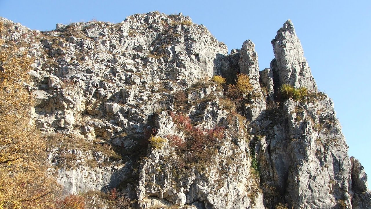
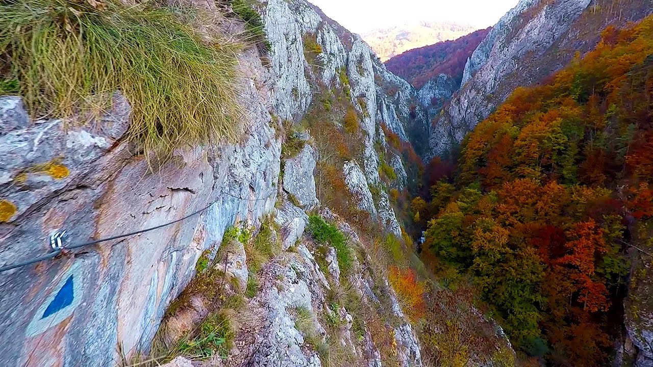
Ticuiata Rock - Trascau Mountains | Photos
Hiking photos and videos Login Register
Select language: - Magyar - Romana - Deutsch - Français - Italiano - Español -
Select language: - Magyar - Romana - Deutsch - Français - Italiano - Español -


Page no. 1, photos: 1-10, 12 photos in total. >>>

Copyright © 2018 - 2025 Trekkingklub.com.
Already published 8983 photos and 180 videos. Please register for full and ad-free access.
Photos of nearby places


Stone of Cetea, Horse Pit (The pit cave from the Stone of Cetea) - Trascau Mountains (16 photos) 5.57 km away


Goat Stone (Piatra Craivii, Piatra Craivei, Apulon) - Craiva, Trascau Mountains (18 photos) 6.9 km away


Dark Blue Bruises of the Ponor (Vanatarile Ponorului) - Trascau Mountains (16 photos) 15.28 km away
The Dark Blue Bruises of the Ponor (Vanatarile Ponorului) is a polje-type protected area. Polje is a Slovenian word meaning plain, and it refers to a surface karst form.
[ Top ↑ ]
Videos of nearby places
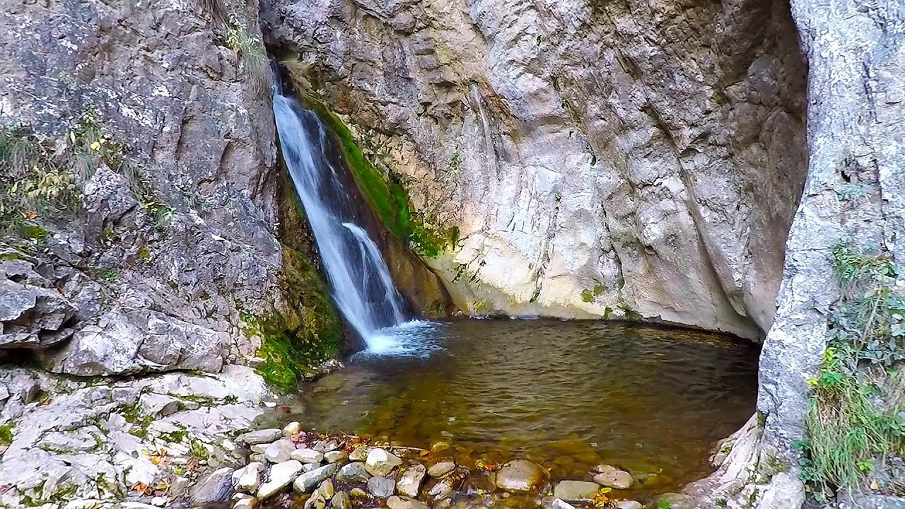
Roman Baths (Baile Romane) - Cetea, Trascau Mountains 0.12 km away
Among the valleys of the Trascau Mountains, the Cetea Gorge best deserves the name of a crevice valley. Here, the waters of the Cetea Stream cut through the Mariuta limestone cliff, flowing through a narrow crevice that is only about 1-2 meters wide.
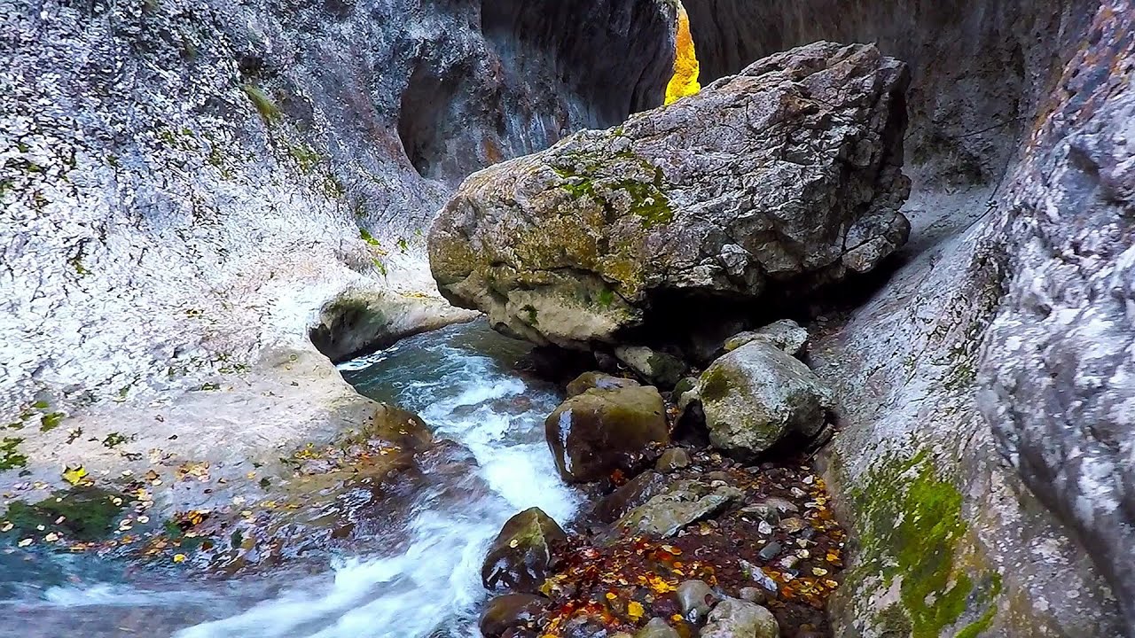
Ramet Gorge (Cheile Rametului) - Goagiu Creek (Paraul Goagiu), Trascau Mountains 8.13 km away
The Ramet Gorge is the wildest canyon in the Trascau Mountains. Where the valley of the Ramet (Goagiu) Creek is now, there once was an extensive cave system.
Other places
Walking to the top of Sumuleul Mare Sumuleu Ciuc 176.17 km away
This was my first attempt at shooting a video.
This was my first attempt at shooting a video.
Lady's Stones Rarau Mountains 202.55 km away
The Lady's Stones represent the heart, the mind, and the soul. The first two only help to understand the world when one possesses knowledge (they can be climbed with rock climbing gear), as emotions and thoughts (the two rock towers) obscure reality (the view).
The Lady's Stones represent the heart, the mind, and the soul. The first two only help to understand the world when one possesses knowledge (they can be climbed with rock climbing gear), as emotions and thoughts (the two rock towers) obscure reality (the view).
Little Spiral via ferrata Baia de Fier 118.58 km away
The Gorge of the Creek of the Gorge (Cheii Gorge, Cheile Cheii) Buila-Vanturarita National Park 118 km away
The Gorges of the Creek of the Gorge (Cheii Gorge, Cheile Cheii) is located in the Buila-Vanturarita National Park within the Capatana Mountains. It is one of the most beautiful and picturesque gorges in Romania.
The Gorges of the Creek of the Gorge (Cheii Gorge, Cheile Cheii) is located in the Buila-Vanturarita National Park within the Capatana Mountains. It is one of the most beautiful and picturesque gorges in Romania.
[ Top ↑ ]
[ Top ↑ ]
Copyright © 2003-2025 Trekkingklub and friends. Reproduction of any text, picture or video from this website, either in printed or electronic form, is prohibited without prior written permission.
The given distances are to be understood as straight line distances, and are approximate. Website made in Miercurea Ciuc  .
.