Saint Ann lake - photos

65032594350
65032614351
65032644352
65032714353
65032734354
65032744355
65032804356
65032844357
Page no. 1, photos: 1-8, 9 photos in total. >>>

[ Hu ] - [ Ro ] - Hiking - Ciomat-Puturosu
19th February 2004. Copyright © 2004 - 2024 Trekkingklub.com.
Already published 8093 photos and 90 videos. Please register for full access.

Photos of nearby places

Saint Ann lake
Saint Ann lake (19th March 2006 - 22 photos) 0 km away
Mohos peat bog
Mohos peat bog (10th May 2004 - 4 photos) 1.3 km away
Apor bastion, Ludmila look-out point - Baile Tusnad
Apor bastion, Ludmila look-out point - Baile Tusnad (14th March 2007 - 8 photos) 2.91 km away
Falcon's Rock - Bixad
Falcon's Rock - Bixad (18th April 2010 - 12 photos) 3.34 km away
Falcon's Rock - Bixad
Falcon's Rock - Bixad (4th March 2004 - 6 photos) 3.34 km away
Healing springs - Jombor creek baths
Healing springs - Jombor creek baths (22nd June 2009 - 15 photos) 3.78 km away
Hawks Rock - Tusnad Bath
Hawks Rock - Tusnad Bath (28th February 2004 - 12 photos) 3.79 km away
[ Top ↑ ]

Videos of nearby places

Saint Anne lake - Ciomat-Puturosu 0.05 km away
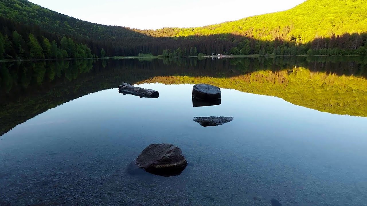
Lake Saint Anna is the only well-preserved volcanic crater lake in Eastern Europe. Here are some images from an afternoon outing.
Preacher's Rock - Bodoc Mountains 12.26 km away
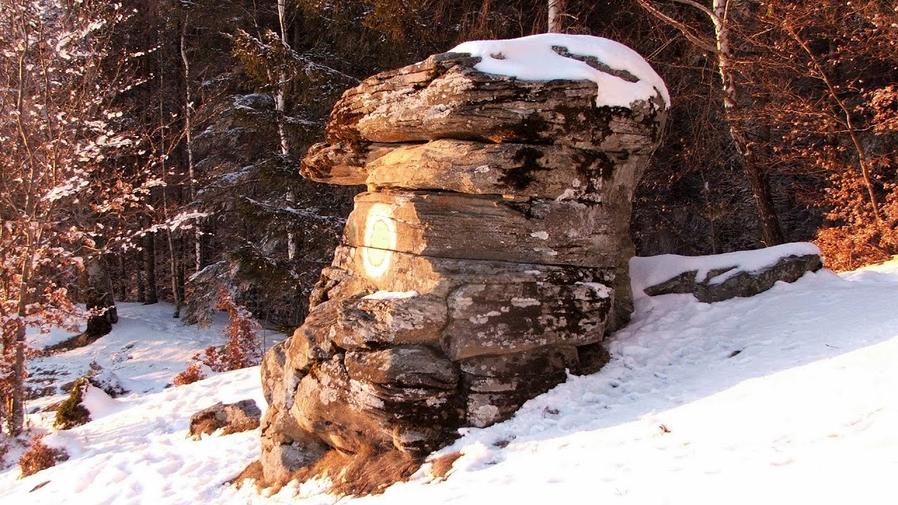
In the Bodoc Mountains, west-southwest from the Henter peak, we find a rock formation shaped like a mushroom by erosion, called Preacher's Rock. This 2-meter high rock probably got its name from the pagan Hungarian priests, who preached here in the past.
Nobody's lake - Miercurea Ciuc 27.02 km away
The passage of time (time lapse), dusk at Nobody's Lake. Miercurea Ciuc and the Sumuleu mountain can be seen in the background.
Walking to the top of Sumuleul Mare - Sumuleu Ciuc 27.25 km away
This was my first attempt at shooting a video.
Varghis gorges in winter 28.28 km away
I went out to admire the ice stalagmites (standing icicles) in the Varghis Gorge. Anyone arriving here at the end of winter can observe meter-high ice stalagmites in the entrance area of Meresti Cave (now known as Orban Balazs Cave).

Other videos

L'Escale á Peille iron path Alpes-Maritimes, France 1473.32 km away
One of the challenging via ferratas in the Maritime Alps is the L'Escale a Peille. One of its elements is a steel cobweb, where you can feel like you're hanging in the air.
Snow-covered valley of Balea and the Transfagarasan in winter The ascent 113.04 km away
The Fagarasi Mountains can be easily approached from the north, mainly by using the Transfagarasan Road. This road is only accessible during the summer months (throughout its entire length), but from the Balea Waterfall station (Statia Balea Cascada) you can also reach the Balea Lake by cable car.
Rieseneishöhle Dachstein Salzkammergut, Austria 937.79 km away
The second cave open to the public, of Schönbergalm above Obertraun am Hallstättersee, is the Ice Cave (Rieseneishöhle). For me, it was more spectacular than the Mammoth Cave.
Bolii Cave Banita 212.69 km away
The Bolii Cave is located 6 km north of Petrosani, on the road that connects Hateg with the Jiu Valley. Here, the railway line that connects the two parts of Hunedoara County passes through, featuring a total of 66 curves and 8 tunnels.
Aareschlucht Meiringen-Innertkirchen, Switzerland 1353.19 km away
The Aareschlucht is a 1400-meter long, 200-meter deep gorge of the Aare river, near Innertkirchen, Switzerland. It has two entrances, one from Meiringen in the west, and one from Innertkirchen in the east, which lead into the narrow, but stunning gorge.
Rosina Klettersteig Silberkarklamm, Ramsau am Dachstein 937.15 km away
The Rosina Klettersteig is the most difficult via ferrata in the Silberkar gorge, has a D difficulty rating, and it is a vertical masterpiece. After a short suspension bridge above the stream, it leads up the rock wall next to the gorge waterfall, all the way vertically.
Rudariei watermills Eftimie Murgu 326.53 km away
I have visited the twenty-two wooden water mills with horizontal wheels, located in the valley of the Rudaria stream, mostly in the rain and under an umbrella. Some of them are still in use today. In 1874, there were still fifty such water mills operating in the village.
Les Gorges de la Méouge France 1583.31 km away
Following today's climb, I experienced the soothing pleasure of immersing myself in the turquoise waters of the Méouge creek, in the pond beneath a waterfall. If you find yourself in Sisteron or Grenoble, do not miss the opportunity to explore the magnificent Méouge valley near Ribiers. And do not leave your swimwear behind.
Poienii Rock, north-eastern lookout point Bicaz Gorges 76.11 km away
From the viewpoint at the top of the northeastern wall of Poienii Rock in the Bicaz Gorges, we can look down 300 meters to the mouth of the Bicajel stream. The Bridge of the Hungarians is hidden among pine trees. The road winds through Hell's Mouth, between Bardos Mountain and Surducul Stone.
Black Rocks iron path Bihor Mountains 253.72 km away
Black Rocks is located in the Bihor Mountains, near the Vartop Saddle, to the west of it. It is interesting that the locals (if I understood correctly) do not know this name, but use the name Piatra Buna (meaning Good Stone) for this spectacular rock.
Stan Valley Canyon in winter 130.78 km away
The Stan Valley is a picturesque canyon, even in winter. In fact, when the stream is frozen and covered with a layer of snow, exploring the canyon becomes much quicker and easier. During this time, we can also access areas that were unreachable in the summer, due to high water levels.
Schulter Anstieg klettersteig Hoher Dachstein, Austria 945.37 km away
Two iron paths lead to the top of the Hoher Dachstein. The Randkluft is shorter, but can only be reached through a glacier with cracks. It is dangerous to reach the starting point, that's probably why it was closed now.
Via ferrata du Diable France 1487.68 km away
The Devil's Iron Path (Via ferrata du Diable) is a multi-part via ferrata, located above a spectacular waterfall (Cascade du Nant), in a gorge, below the Victor-Emmanuel fort. For me, this climbing route presented the greatest challenge so far.
Seven Ladder Canyon and Waterfall Piatra Mare Mountain 64.97 km away
The Seven Ladder Gorge is the largest and most spectacular gorge in the Piatra Mare massif. The narrow canyon has a length of 160 meters, and over a drop of 58 meters includes 7 bigger and several smaller waterfalls. The gorge can be explored on metal stairs and platforms.
Ski Gyimes ski slope Lunca de Sus 44.19 km away
The Ski Gyimes ski slope is located in Lunca de Sus, right next to the main road. It is 800 m long, the level difference is 160 m. There are two lifts that takes you up to an altitude of 1060 meters above sea level.
[ Top ↑ ]
[ Top ↑ ]
Copyright © 2003-2024 Trekkingklub and friends. Reproduction of any text, picture or video from this website, either in printed or electronic form, is prohibited without prior written permission. Nearby settlements: Carpitus 2.39 km away, Tourist attractions Bixad 3.21 km away. The given distances are to be understood as straight line distances, and are approximate. Website made with love Made with love in Miercurea Ciuc.