Tourist attractions near Campani (Campani, Bihor county, Romania)
Photos of nearby places


[ Top ↑ ]
Videos of nearby places

Black Rocks iron path - Bihor Mountains 8.38 km away
Black Rocks is located in the Bihor Mountains, near the Vartop Saddle, to the west of it. It is interesting that the locals (if I understood correctly) do not know this name, but use the name Piatra Buna (meaning Good Stone) for this spectacular rock.

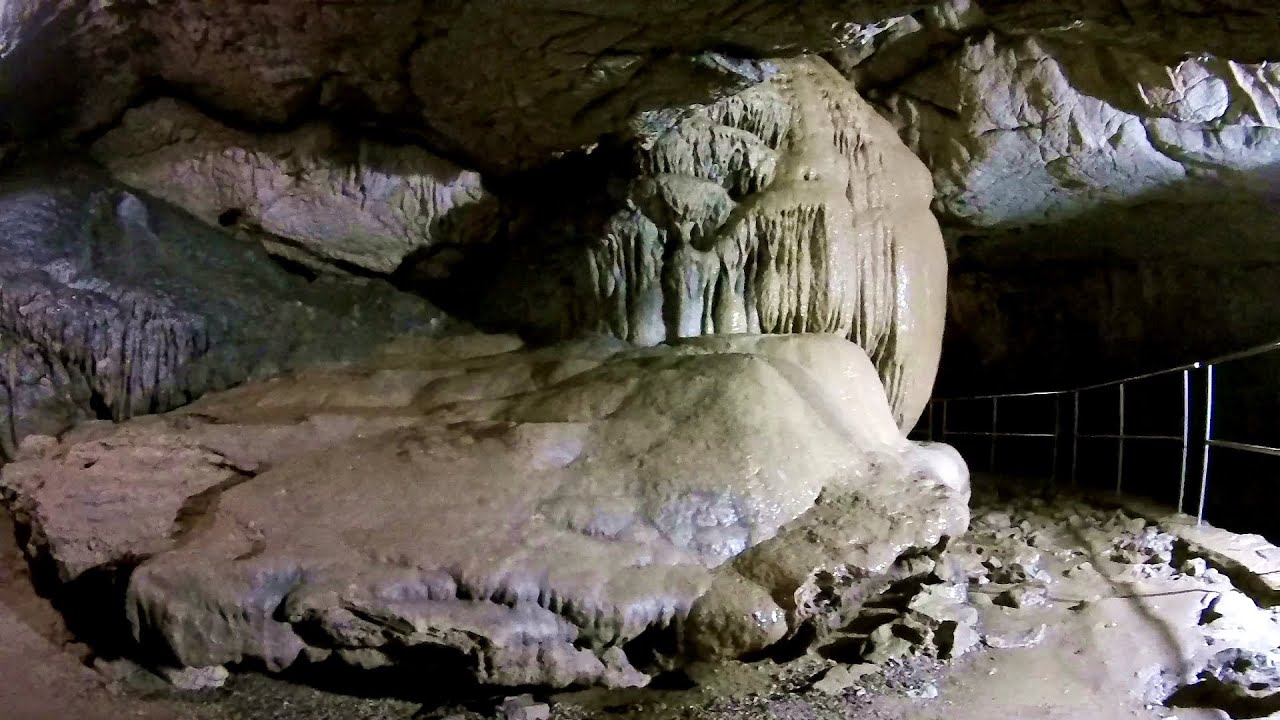
Meziad cave - Padurea Craiului Mountains 27.85 km away
The Meziad Cave is located near the village of Meziad, 22 km north of Beius, in the Padurea Craiului Mountains. It is one of our first tourist caves, its exploration is associated with the name of Gyula Czárán, cave researcher and writer.

Crystal Cave at Farcu Mine 34.53 km away
In the Padurea Craiului Mountains, near Rosia, in the Farcu bauxite mine, in 1987, the miners accidentally discovered a cave. It was filled with crystal-shaped limestone formations.

Hodoaba Valley iron path - Suncuius 46.56 km away
The Hodoaba Valley iron path is Romania's shortest and easiest (official) via ferrata route. It is located near Suncuius, in the Padurea Craiului Mountains, on the left bank of the Crisul Repede River.
Vadu Crisului cave 49.79 km away
The Vadu Crisului Cave, with a total length of over 1000 meters, is located in the picturesque gorge of Crisul Repede creek. It consists of a gently meandering, long passage that features an active, stream level next to an upper, fossil level in its first section.
Other places
Silberkar Gorge (Silberkarklamm) Ramsau am Dachstein, Austria 675.49 km away
One of the most beautiful hiking spots in the area of Ramsau am Dachstein, is the Silberkarklamm. It is possible to drive to the entrance of the gorge, there is parking available on the side of the road, and you have to pay an entrance fee.
One of the most beautiful hiking spots in the area of Ramsau am Dachstein, is the Silberkarklamm. It is possible to drive to the entrance of the gorge, there is parking available on the side of the road, and you have to pay an entrance fee.
Sky Walk, Suspension Bridge, Stairway to Nothingness Styria, Dachstein 682.72 km away
The Dachstein cable car (Gletscherbahn Panorama Gondel, Panorama Cable Car) took me up to a height of 2700 meters, to the highest mountain in Styria (Steiermark), the Dachstein. Next to the upper station of the cable car there are several tourist attractions.
The Dachstein cable car (Gletscherbahn Panorama Gondel, Panorama Cable Car) took me up to a height of 2700 meters, to the highest mountain in Styria (Steiermark), the Dachstein. Next to the upper station of the cable car there are several tourist attractions.
Kaiser Franz-Josef Klettersteig Leopoldsteiner See 592.76 km away
The Franz-Josef Klettersteig is located on the Seemauer cliff face, which rises 900 meters above Leopoldsteiner Lake, in the western part of the Hochschwab mountain range, just 4 km from the town of Eisenerz. This via ferrata is named after the Kaisersteig, a hunting trail established for the esteemed Emperor Franz Joseph I of Austria and Hungary at the end of the 19th century, traces of which can still be observed today.
The Franz-Josef Klettersteig is located on the Seemauer cliff face, which rises 900 meters above Leopoldsteiner Lake, in the western part of the Hochschwab mountain range, just 4 km from the town of Eisenerz. This via ferrata is named after the Kaisersteig, a hunting trail established for the esteemed Emperor Franz Joseph I of Austria and Hungary at the end of the 19th century, traces of which can still be observed today.
Schulter Anstieg klettersteig Hoher Dachstein 683.87 km away
Two routes lead to the top of the Hoher Dachstein. The Randkluft is shorter, but can only be reached through a glacier with cracks.
Two routes lead to the top of the Hoher Dachstein. The Randkluft is shorter, but can only be reached through a glacier with cracks.
Trift valley, bridge, lake and glacier Gadmen, Switzerland 1080.75 km away
During the hike in Trift Valley, I experienced cloudy and gloomy weather with intermittent rain. Here is the 170 m long Trift Bridge, the longest pedestrian suspension bridge in the Swiss Alps, in a breathtaking environment, 100 meters above the Trift Glacier Lake.
During the hike in Trift Valley, I experienced cloudy and gloomy weather with intermittent rain. Here is the 170 m long Trift Bridge, the longest pedestrian suspension bridge in the Swiss Alps, in a breathtaking environment, 100 meters above the Trift Glacier Lake.
[ Top ↑ ]
Copyright © 2003-2025 Trekkingklub and friends. Reproduction of any text, picture or video from this website, either in printed or electronic form, is prohibited without prior written permission. Website made with love  in Miercurea Ciuc.