Tourist attractions near Malnas (Malnas, Covasna county, Romania)
Photos of nearby places


Cavities in Tipia of Ormenis - Persani Mountains (24 photos) 28.7 km away. Cavities in Tipia of Ormenis - Persani Mountains (Muntii Persani).

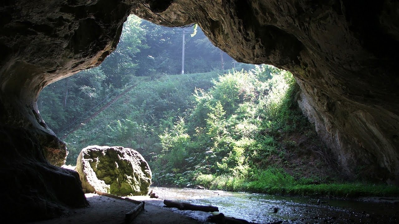
Thieves Cave - Persani Mountains (20 photos) 28.7 km away. The Thieves' Cave at Apata is located in the valley of the Tepeu creek, renowned for its outcrop of red clayey limestone, which is very rich in ammonites. A tributary of the stream is formed by the waters of a spring fed by the watercourse coming from the cave's gallery.

Veczer Rock (12 photos) 31.5 km away. The Veczer Rock is located 3 km south of the village of Ariusd, on the southern slope of the place named Veczer. The tall hill is encircled by the Olt River, with conglomerate rocks resembling giants stretching above the river.

Ruins of the Harom fortress - Jigodin Bath (10 photos) 34.6 km away. The Harom Fortress was built around the beginning of the 12th century and was part of the system of fortifications that protected Transylvania from the east. It is located south of Miercurea Ciuc, east of Harom Peak, which has an altitude of 1079 m, near the southwestern limits of Jigodin Bath (Baile Jigodin).

Surroundings of Covasna town (24 photos) 35.6 km away. Fortress of Fairies, Narrow gauge railway Covasna-Comandau


Shells Cave - Persani Mountains (33 photos) 42.7 km away. Shells Cave (Pestera Scoicilor) - Persani Mountains (Muntii Persani).

Harghita Bath - Harghita Mountains (15 photos) 44.7 km away. Harghita Bath (Harghita-Bai) - Harghita Mountains.


The sources of the river Trotus - Fagetel (10 photos) 49.9 km away. Fagetel, Piposz property, The sources of the river Trotus (Tatros).

Devils Hand Rock - Ciucas Mountains (30 photos) 50.4 km away. Dalghiu - Devil's Hand Rock - Ciucas peak - Vama Buzaului

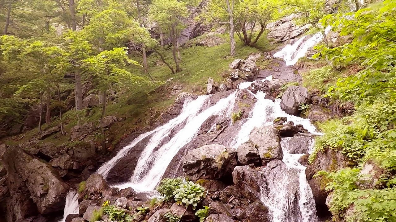
Seven Ladder Waterfall - Piatra Mare Mountains (12 photos) 51.4 km away. The Seven Ladders are located in the middle-western part of the Piatra Mare Mountains, at an average altitude of 980 m, not far away from Valea Timisului (Dambu Morii), on the Seven Ladders River, the left-side affluent of Sipoaia creek. These are the greatest and the most spectacular gorges of the whole Piatra Mare Mountains.


Piatra Mare peak and surroundings (24 photos) 52.9 km away. Piatra Mare hut - Piatra Mare peak - Stone Mushrooms - Stone Barn.

Red Mountain, Tigaile Mari - Ciucas Mountains (24 photos) 55.2 km away. Red Mountain - Tigaile Mari.


Muntele Rosu - Ciucas Mountains (12 photos) 57.5 km away. Muntele Rosu (Red Mountain) - Ciucas Mountains.


Rák lake - Porumbenii Mari (15 photos) 62.8 km away. The Rak lake is located 2 km north of the village Porumbenii Mari, at 600 m altitude. The circumference of the lake is 800 m, the length 250 m, width 150 m, maximum depth 7 m, and the surface is 28000 m2 (10 ha together with the joined area).
[ Top ↑ ]
Videos of nearby places

Preachers Rock - Bodoc Mountains 4 km away. In the Bodoc Mountains, west-southwest from the Henter peak, we find a rock formation shaped like a mushroom by erosion, called Preacher's Rock. This 2-meter high rock probably got its name from the pagan Hungarian priests, who preached here in the past.

Saint Anne lake - Ciomat-Puturosu 13.5 km away. Lake Saint Anna is the only well-preserved volcanic crater lake in Eastern Europe. Here are some images from an afternoon outing.
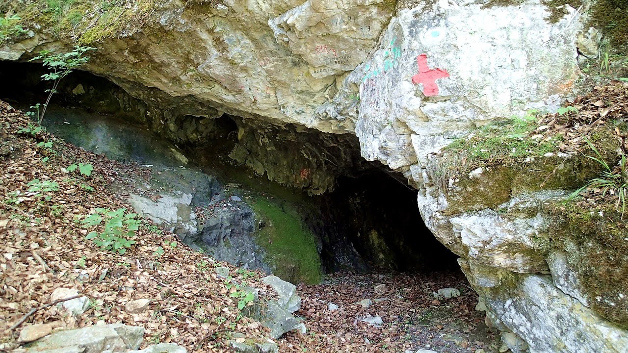
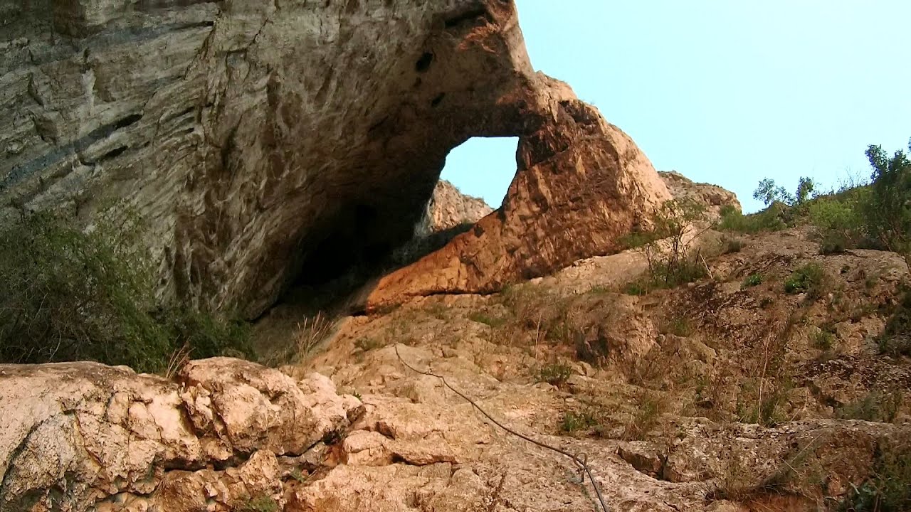
The Cave of Thieves - Apata 28.7 km away. The Cave of Thieves (Pestera Hotilor, Tolvajos), located in the Olt Gorge at Racos, is situated at the source of the Tepeu creek. From the karst spring that emerges from the cave, one of the branches of the creek originates.
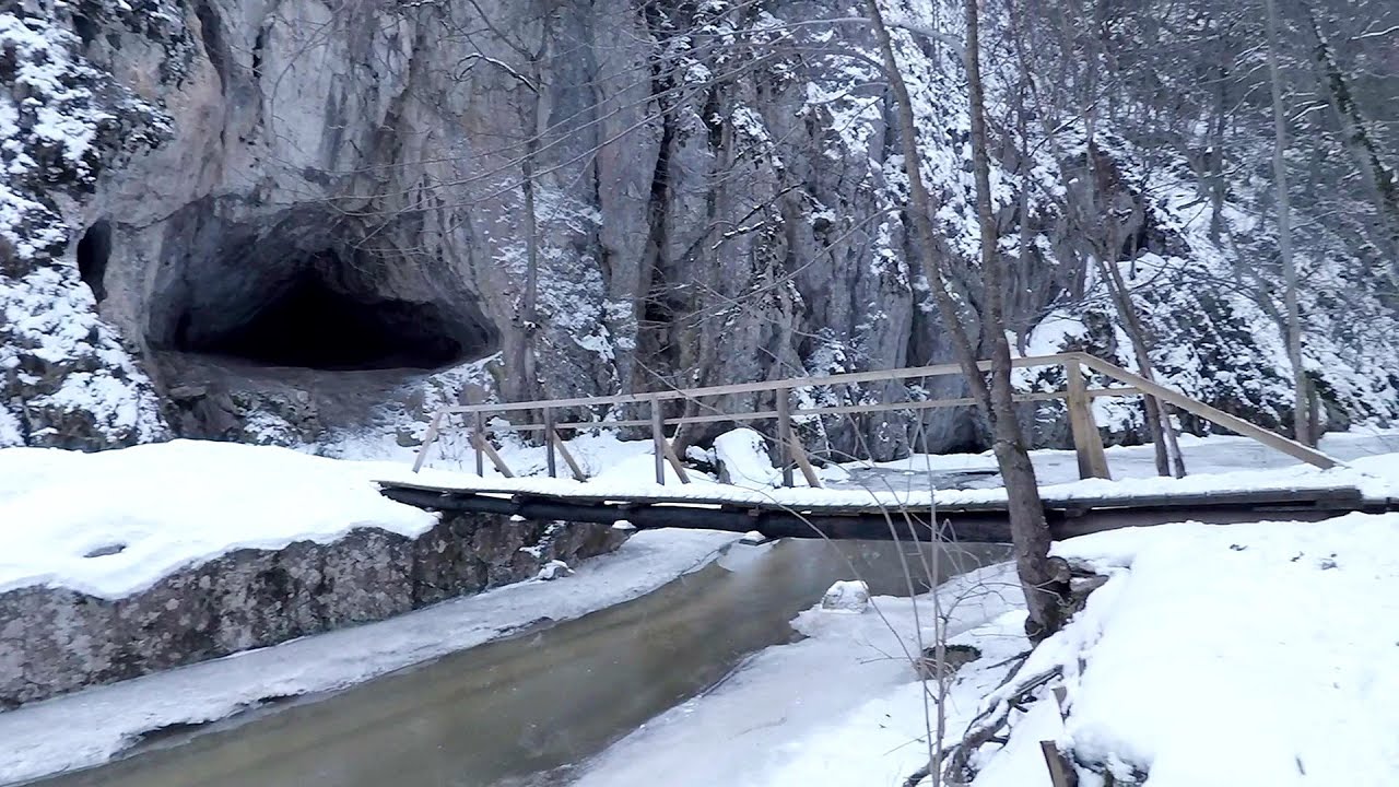
Varghis gorges in winter 32.7 km away. I went out to admire the ice stalagmites (standing icicles) in the Varghis Gorge. Anyone arriving here at the end of winter can observe meter-high ice stalagmites in the entrance area of Meresti Cave (now known as Orban Balazs Cave).

Other places

Stone Forest Slanchevo 342.5 km away. The Stone Forest (Stones stuck in the ground, Pobiti Kamani) of Bulgaria is located 18 km west of Varna, at the foothills of the Eastern Balkan Mountains. Its Bulgarian name, Pobiti Kamani, translates to planted stones, and it is referred to in English as the Stone Desert or Stone Forest.
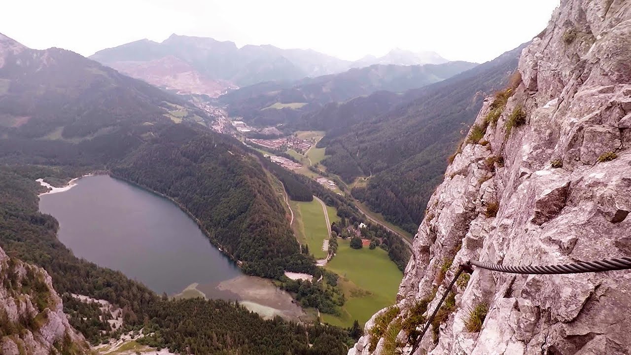
Kaiser Franz-Josef Klettersteig Leopoldsteiner See The Franz-Josef Klettersteig is located on the Seemauer cliff face, which rises 900 meters above Leopoldsteiner Lake, in the western part of the Hochschwab mountain range, just 4 km from the town of Eisenerz. This via ferrata is named after the Kaisersteig, a hunting trail established for the esteemed Emperor Franz Joseph I of Austria and Hungary at the end of the 19th century, traces of which can still be observed today.
Mucanj via ferrata and the Boze Javorca cave Ravna Gora Difficulty level C/D, total length: 500 m, height difference: 200 m, year of construction: 2022. The via ferrata is free to climb.
With snowshoes in the Tihu creek valley Rastolita 133.1 km away. We met geotrekking treasure hunters from Gheorgheni, Miercurea Ciuc and Targu Mures in Rastolita. We entered the Calimani Mountains with an off-road vehicle, along the Rastolita and Tihu streams.
Babsko Praskalo waterfall Tazha 372.8 km away. In the Central Balkans National Park, there are many rivers that cascade down spectacular waterfalls, which the locals call praskalo. One of the smallest waterfalls in the area is Babsko Praskalo, which stands at only 54 meters high.
Hilis cave Turda Gorge via ferrata 177.5 km away. While the first time I climbed this via ferrata (Sky Fly) in the morning, now I climbed it in the light of the setting sun. The red-dressed rocks created a special atmosphere, and I could admire the sunset from the top of the climbing route.
Eagles Eye Yagodina Orlovo Oko (Eagle's Eye) is a lookout viewpoint located in the Rhodope Mountains, near the peak of Saint Ilia and close to the village of Yagodina, Bulgaria. The steel structure, built at an altitude of 1,563 meters, rises 670 meters above the spectacular Buynovsko Gorge, along with the winding river and road that traverse it.

Devils Bridge Ardino 491.4 km away. The Devil's Bridge (Dyavolski Most, in Turkish Sheytan Kyupriya) is located in the gorge of the Arda River, just north of the town of Ardino in Bulgaria. It was constructed in the early 16th century, between 1515 and 1518, by an architect named Dimitar, on the remains of an earlier Roman bridge.
Boli Cave Banita 205.4 km away. The Boli Cave is located 6 km north of Petrosani, on the road that connects Hateg with the Jiu Valley. Here, the railway line that connects the two parts of Hunedoara County passes through, featuring a total of 66 curves and 8 tunnels.
[ Top ↑ ]
Copyright © 2003-2026 Trekkingklub and friends. Reproduction of any text, picture or video from this website, either in printed or electronic form, is prohibited without prior written permission. Website made with love  in Miercurea Ciuc.