Tourist attractions near Macin (Macin, Tulcea county, Romania)
Photos of nearby places

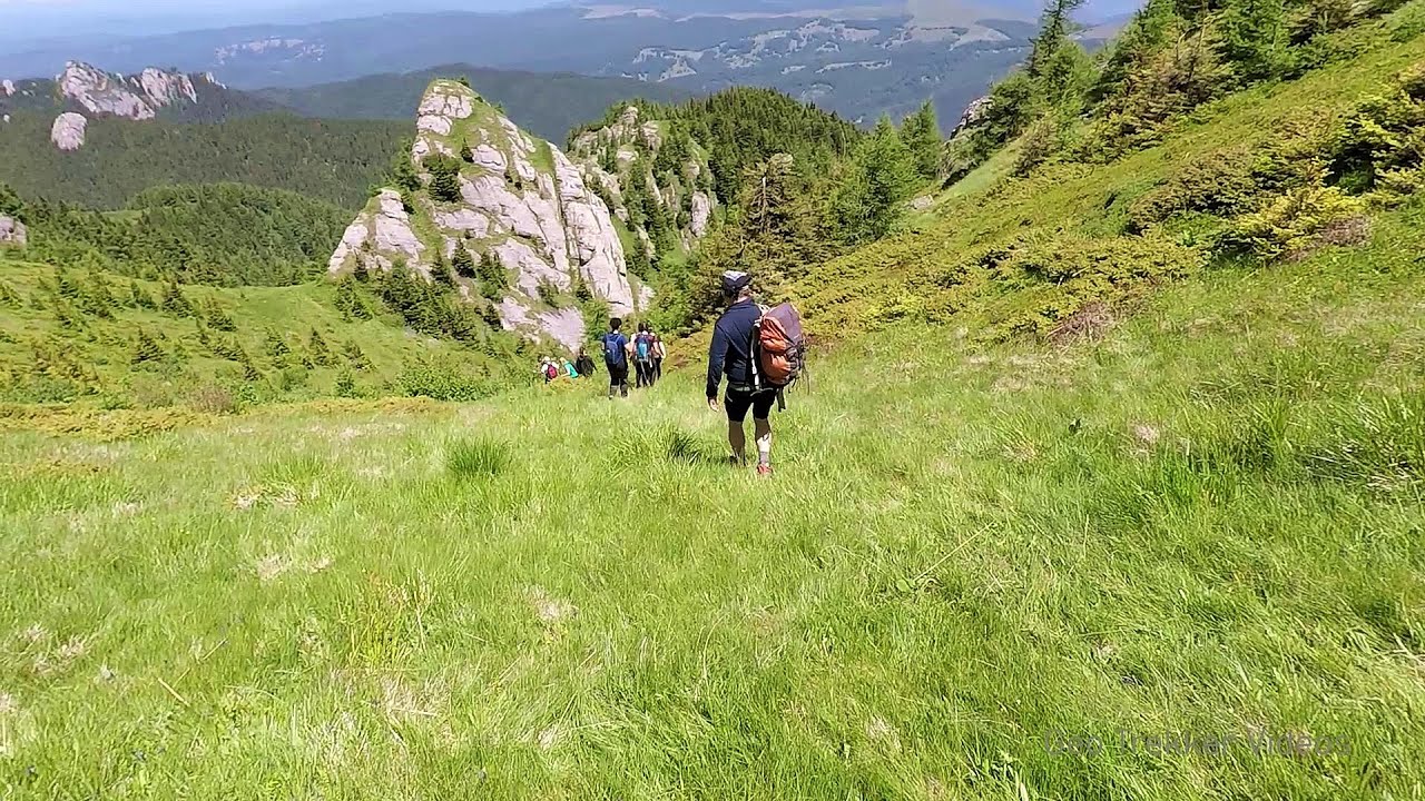
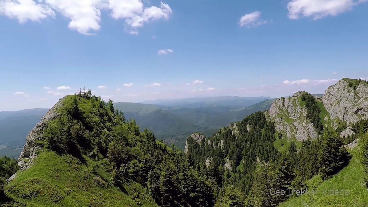
Pricopanului ridge - Macin Mountains (61 photos) 3.5 km away. Pricopanului ridge is the secondary, but imposing ridge of Macin Mountains, characterized by huge granite formations, lofty rocks and wide sceneries all around. The landscape, as well as the relief is of mountain type, and even if the height of the ridge is apparently small, the ascending effort is slighty sustained.

White dacitic tuff - Manzalesti (4 photos) 120.1 km away. The 'Grunjul de la Manzalesti' is composed of dacitic tuff, which originates from volcanic ash. It is located in the center of the Manzalesti commune, Buzau county, at the confluence of the Slanic and Jgheab streams.


Chiojdu (18 photos) 154.6 km away. Basca cu Cale - La Sipot waterfall - Basca fara Cale - Tata Lice boarding-house - Chiojdu village.

Surroundings of Covasna town (24 photos) 162.6 km away. Fortress of Fairies, Narrow gauge railway Covasna-Comandau

Round rocks from Viisoara - Berzunti (12 photos) 163.2 km away. Round rocks are quite a common curiosity, apart from those in Costesti, Valcea county, there are numerous other locations with similar rock formations. The round rocks from Viisoara are located northwest of the village, at a distance of approximately 700 meters from DC152 road.

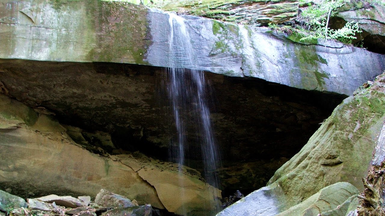
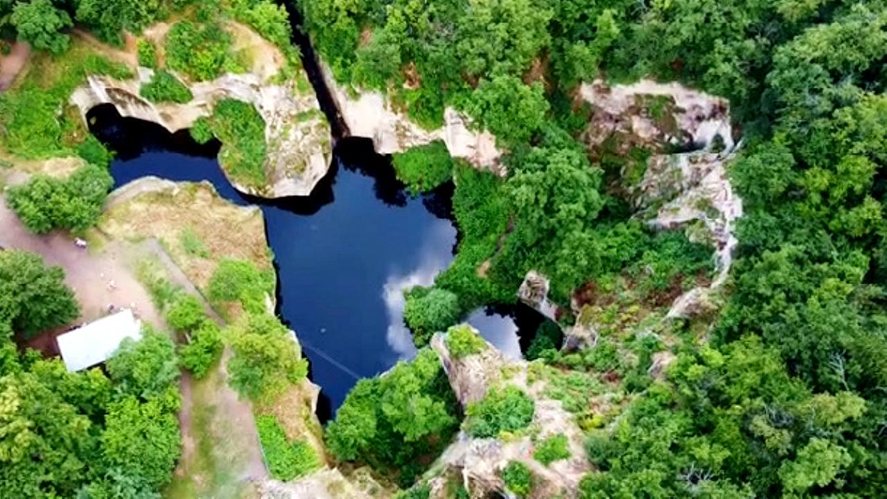
The waterfalls of Velnita stone-quarry - Left side (18 photos) 163.6 km away. Fan waterfall, Side waterfall, Double-decked waterfall, Waterfall with stairs, Hammock waterfall, Terrrace waterfall, The waterfall behind the arch, Suspended rock cube, Brown waterfall, Ceiling waterfall.

The waterfalls of Velnita stone-quarry - Right side (16 photos) 164 km away. The waterfall from the quarry, Green waterfall, Water-jet waterfall, Run down waterfall.

Devils Hand Rock - Ciucas Mountains (30 photos) 171.9 km away. Dalghiu - Devil's Hand Rock - Ciucas peak - Vama Buzaului

Muntele Rosu - Ciucas Mountains (12 photos) 172.3 km away. Muntele Rosu (Red Mountain) - Ciucas Mountains.

Red Mountain, Tigaile Mari - Ciucas Mountains (24 photos) 174.9 km away. Red Mountain - Tigaile Mari.

Ezerets beach - Shabla, Dobrich (10 photos) 187.3 km away. The beach near the village of Ezerets is semi-wild, relatively quiet and clean, without sunbeds or umbrellas. The sand is fine-grained, and the water is clear.

Bird Observatory at Shabla Tuzla Lake (11 photos) 191.1 km away. Three coastal lakes - Shabla, Ezerets, and Shabla Tuzla - support a great variety of plants and animals. The lakes are especially important in winter, and they are protected to provide a refuge for their unique wildlife.

Beer waterfall - Gosmanu Ridge (12 photos) 192.6 km away. Beer waterfall (Cascada Berea) - Gosmanu Ridge, Tarcau Mountains.

Fortress Kariya and the Lighthouse on Cape Shabla (13 photos) 193.4 km away. Shabla's lighthouse marks the easternmost point of Bulgaria. With its 32-meter height, it is the oldest and tallest lighthouse on the Black Sea.


Stone Sea and Little Sea beach - Shabla (10 photos) 195.5 km away. Monument of fallen Soviet aviators (May 17, 1944), Stone Sea and Little Sea beach - Shabla.


Piatra Mare peak and surroundings (24 photos) 197.1 km away. Piatra Mare hut - Piatra Mare peak - Stone Mushrooms - Stone Barn.

The coast of the Black Sea north of Tyulonovo (36 photos) 197.3 km away. The Portal, the Salt Pools, the Wild Frog's Point, the Seal Cave, the Passage and the Whale.
[ Top ↑ ]
Videos of nearby places
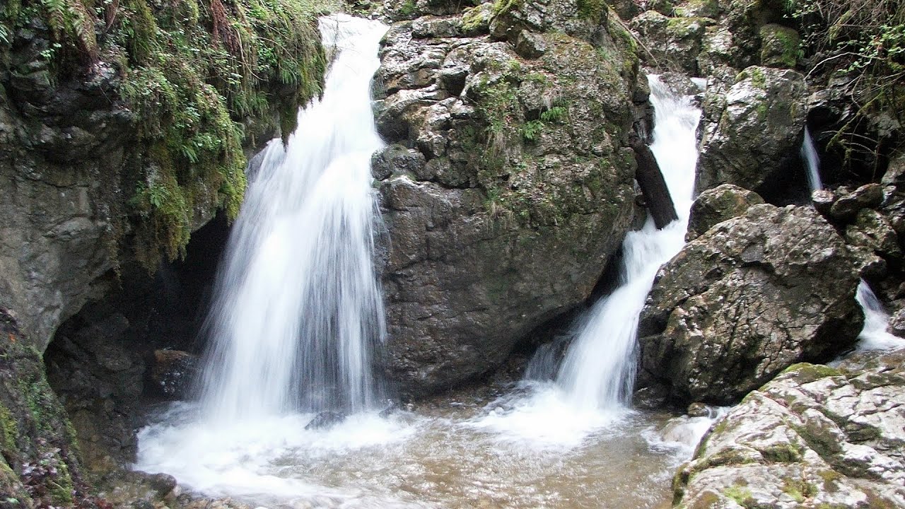
Waterfalls of Velnita stone-quarry - Targu Ocna 164.1 km away. Starting from the Velnita quarry, an adventurous nature enthusiast, accustomed to wild and rugged terrains, will discover a true waterfall paradise. At the upper part of the quarry, two streams converge.
Searching for rhododendrons - Ciucas Boulevard 171.5 km away. Red Mountain (Muntele Rosu), Gropsoarele-Zaganu ridge - Ciucas Mountains

Preachers Rock - Bodoc Mountains 194.3 km away. In the Bodoc Mountains, west-southwest from the Henter peak, we find a rock formation shaped like a mushroom by erosion, called Preacher's Rock. This 2-meter high rock probably got its name from the pagan Hungarian priests, who preached here in the past.

Seven Ladder Canyon and Waterfall - Piatra Mare Mountain 197.9 km away. The Seven Ladder Gorge is the largest and most spectacular gorge in the Piatra Mare massif. The narrow canyon has a length of 160 meters, and over a drop of 58 meters includes 7 bigger and several smaller waterfalls.
Other places

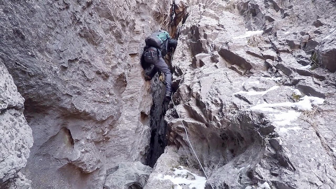
Iron path in winter Harghita Madaras 240.4 km away. This is already the sixth time I've climbed the via ferrata route set up on the rocky cliffs of Seii Peak near Harghita Madaras. Although the forecast suggests that the weather should be nice, I am greeted by a sky covered in clouds.
Seven Ladder Canyon and Waterfall Piatra Mare Mountain 197.9 km away. The Seven Ladder Gorge is the largest and most spectacular gorge in the Piatra Mare massif. The narrow canyon has a length of 160 meters, and over a drop of 58 meters includes 7 bigger and several smaller waterfalls.
Mine lake Megyer mountain, Sárospatak The via ferrata routes of the Megyer mountain mine lake. The geologists' path E 25 m, Szabó József-memorial path C 200 m, Amphitheater D 40 m, Devil's Cauldron E 70 m, Sweet aquatic life D 150 m, Velociraptor C 35 m.

Meziad cave Padurea Craiului Mountains 468.3 km away. The Meziad Cave is located near the village of Meziad, 22 km north of Beius, in the Padurea Craiului Mountains. It is one of our first tourist caves, its exploration is associated with the name of Gyula Czárán, cave researcher and writer.

Blasted Rock hanging path Cerna Valley 438.5 km away. The Blasted Rock (Piatra Puscata) hanging path is located on the geographical right bank of the Cerna River, near the confluence of the Iuta stream, approximately 20 km from Baile Herculane. In this area, the presence of limestone formations has caused the valley to become narrower.
Waterfalls of Lapos creek Bicaz Gorge 249.9 km away. One of the lesser-known attractions of the Bicaz Gorges is the series of waterfalls along Lapos Creek. This creek flows between Cupas Stone and Bardos Stone before eventually merging with Bicaz Creek, forming spectacular waterfalls beneath the Altar Stone.

Stan Valley Canyon 275.7 km away. The Stan Valley is located near Lake Vidraru, southwest of it, in the Fruntii Mountains. Those who have visited the Seven Ladders Waterfall will appreciate this canyon, outfitted with infrastructure for tourist accessibility.

Crivadia Gorge 385.8 km away. The Crivadia Gorge is located next to the village of Crivadia, which belongs to Banita. Access is difficult, and the hike is made through the streambed, with water up to the waist at its narrowest point.
[ Top ↑ ]
Copyright © 2003-2026 Trekkingklub and friends. Reproduction of any text, picture or video from this website, either in printed or electronic form, is prohibited without prior written permission. Website made with love  in Miercurea Ciuc.